Maisenhart
Maisenhart is a locality in Baden-Württemberg, Germany. Maisenhart is situated nearby to the locality Löchle, as well as near Eichhalde.| Tap on a place to explore it |
Places of Interest
Highlights include Katzenbach-Dünnbachtal and Bühler Tal und Unterer Bürg.

Bühler Tal und Unterer Bürg
Nature reserve
 Bühler Tal und Unterer Bürg is a nature reserve, which is situated 3½ km north of Maisenhart.
Places in the Area
Nearby places include Dußlingen and Mössingen.
Dußlingen
Village

Photo: Vux, CC BY-SA 4.0.
Dußlingen is a municipality in the district of Tübingen in Baden-Württemberg in Germany. The village was named for the first time in the records as 'villa Tuzzilinga' in the year 888. Dußlingen is situated 4½ km northeast of Maisenhart.
Mössingen
Town

Photo: UnreifeKirsche, CC BY-SA 3.0.
Mössingen is a town in the district of Tübingen, in Baden-Württemberg, Germany. It is situated north of the Swabian Jura, about 13 km south of Tübingen. Mössingen is situated 5 km southeast of Maisenhart.
Bodelshausen
Village
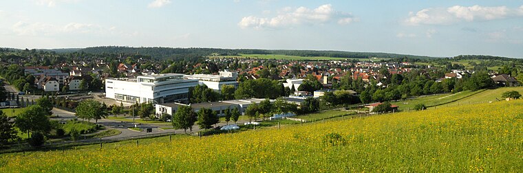
Photo: UnreifeKirsche, CC BY-SA 3.0.
Bodelshausen is a municipality in the district of Tübingen in the German state of Baden-Württemberg. Bodelshausen is situated 5 km southwest of Maisenhart.
Maisenhart
- Type: Locality
- Location: Baden-Württemberg, Germany, Central Europe, Europe
- View on OpenStreetMap
Latitude
48.43358° or 48° 26′ 1″ northLongitude
9.00542° or 9° 0′ 20″ eastOpen location code
8FWFC2M4+C5OpenStreetMap ID
node 13062209875OpenStreetMap feature
place=locality
This page is based on OpenStreetMap, Wikidata, and Wikimedia Commons.
We’d love your help improving our open data sources. Thank you for contributing.
Satellite Map
Discover Maisenhart from above in high-definition satellite imagery.
Localities in the Area
Explore places such as Löchle and Eichhalde.
Notable Places Nearby
Highlights include Hardtsee and Abenteuerspielplatz.
Baden-Württemberg: Must-Visit Destinations
Delve into Stuttgart, Heidelberg, Karlsruhe, and Mannheim.
Curious Localities to Discover
Uncover intriguing localities from every corner of the globe.
About Mapcarta. Data © OpenStreetMap contributors and available under the Open Database License". Text is available under the CC BY-SA 4.0 license, except for photos, directions, and the map. Photo: Traveler100, CC BY-SA 3.0.