Queer History at Hanlan’s Point
Queer History at Hanlan’s Point is a memorial in Ontario, Canada. Queer History at Hanlan’s Point is situated nearby to the protected area Environmentally Signigicant Area, as well as near the pitch Nude Volleyball.| Tap on a place to explore it |
Places of Interest Nearby
Highlights include Gibraltar Point Lighthouse and St. Andrew by-the-Lake Anglican Church.
Gibraltar Point Lighthouse
Lighthouse
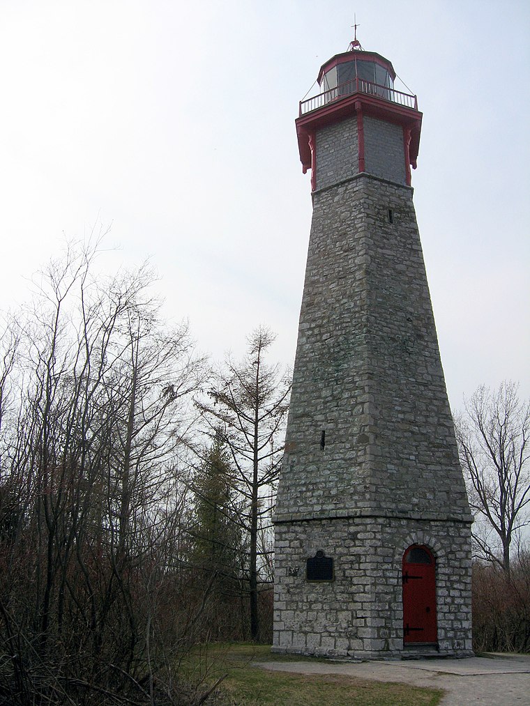
Photo: Wikimedia, CC BY-SA 3.0.
The Gibraltar Point Lighthouse is a lighthouse located on Hanlan's Point, the most westerly of the Toronto Islands in Toronto, Ontario, Canada. Begun in 1808, it is the oldest existing lighthouse on the Great Lakes, and one of Toronto's oldest buildings. Gibraltar Point Lighthouse is situated 620 metres southeast of Queer History at Hanlan’s Point.
St. Andrew by-the-Lake Anglican Church
Church
 St. Andrew by-the-Lake Anglican Church is an Anglican church located on Centre Island, which is part of the Toronto Islands, offshore of Toronto, Ontario, Canada. St. Andrew by-the-Lake Anglican Church is situated 1½ km east of Queer History at Hanlan’s Point.
Little Norway Park
Park

Photo: SimonP, CC BY-SA 3.0.
Little Norway Park is a small park in the Harbourfront area of Toronto, Ontario, Canada, at the southwest corner of Bathurst Street and Queens Quay West. The park is just north of the Western Channel into Toronto Harbour. It was opened in 1986. Little Norway Park is situated 2 km north of Queer History at Hanlan’s Point.
Places in the Area
Nearby places include Fort York and CityPlace.
Fort York
Neighborhood

Photo: SimonP, CC BY-SA 3.0.
Fort York, also known as Garrison, is a neighbourhood in Toronto, Ontario, Canada, located west of Downtown Toronto, north of Billy Bishop Toronto City Airport, and east of Exhibition Place along the shores of Lake Ontario.
CityPlace
Neighborhood
 CityPlace is a neighbourhood in downtown Toronto, Ontario, Canada, within the former Railway Lands. When completed, this area will be the largest residential development ever created in Toronto. CityPlace is situated 2½ km north of Queer History at Hanlan’s Point.
Toronto

Photo: S23678, CC BY-SA 3.0.
Toronto is a diverse, energetic and liveable city, home to many tourist attractions, and seemingly endless dining, shopping and entertainment possibilities.
Queer History at Hanlan’s Point
- Type: Memorial
- Inscription: “Hanlan’s Point has been a meeting and gathering place for Toronto’s 2SLGBTQIA+ community for more than a century. On August 1, 1971, about 250 people participated in a picnic at Hanlan’s. It was the first public event to celebrate gay pride in Canada.”
- Category: historic site
- Location: Ontario, Canada, North America
- View on OpenStreetMap
Latitude
43.61728° or 43° 37′ 2″ northLongitude
-79.39126° or 79° 23′ 29″ westOpen location code
87M2JJ85+WFOpenStreetMap ID
node 13065591874OpenStreetMap feature
historic=memorial
This page is based on OpenStreetMap, Wikidata, and Wikimedia Commons.
We’d love your help improving our open data sources. Thank you for contributing.
Satellite Map
Discover Queer History at Hanlan’s Point from above in high-definition satellite imagery.
Notable Places Nearby
Highlights include Environmentally Signigicant Area and Nude Volleyball.
Nearby Places
Explore places such as Hanlan’s Pavilion Washrooms and Hanlan’s Pavilion Showers.
Ontario: Must-Visit Destinations
Delve into Toronto, Ottawa, Hamilton, and London.
Curious Memorials to Discover
Uncover intriguing memorials from every corner of the globe.
About Mapcarta. Data © OpenStreetMap contributors and available under the Open Database License". Text is available under the CC BY-SA 4.0 license, except for photos, directions, and the map. Photo: Wikimedia, CC BY-SA 2.0.