Figure de proue
Figure de proue is a work of art in Baixas, Arrondissement of Perpignan, Occitanie. Figure de proue is situated nearby to the police station Police municipale, as well as near the town hall Hôtel de Ville.| Tap on a place to explore it |
Places of Interest Nearby
Highlights include Église de la Nativité-de-Notre-Dame de Baixas and Ermitage Sainte-Catherine de Baixas.
Église de la Nativité-de-Notre-Dame de Baixas
Church

Photo: Devisme.alain, CC BY-SA 3.0.
Église de la Nativité-de-Notre-Dame de Baixas is a church, which is situated 270 metres west of Figure de proue.
Ermitage Sainte-Catherine de Baixas
Church
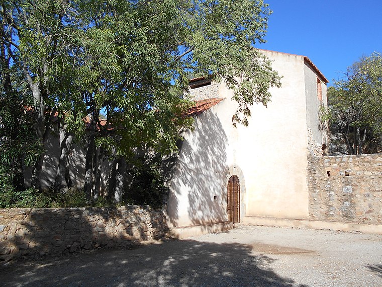
Photo: Claudefà, CC BY-SA 4.0.
Ermitage Sainte-Catherine de Baixas is a church, which is situated 1¼ km northwest of Figure de proue.
Ermitage Notre-Dame-de-Pène
Church

Photo: Wikimedia, Public domain.
Ermitage Notre-Dame-de-Pène is a church, which is situated 3½ km northwest of Figure de proue.
Places in the Area
Nearby places include Baixas and Peyrestortes.
Baixas
Village

Photo: Devisme.alain, CC BY-SA 3.0.
Baixas is a commune in the Pyrénées-Orientales department in southern France.
Peyrestortes
Village

Photo: Bastien.pierre, CC BY-SA 3.0.
Peyrestortes is a commune in the Pyrénées-Orientales department in southern France. Peyrestortes is situated 3 km east of Figure de proue.
Espira-de-l’Agly
Village

Photo: Culex, CC BY-SA 4.0.
Espira-de-l'Agly is a commune in the Pyrénées-Orientales department in southern France. Espira-de-l’Agly is situated 3½ km northeast of Figure de proue.
Figure de proue
- Type: Work of art
- Artwork type: sculpture
- Category: tourism
- Location: Baixas, Arrondissement of Perpignan, Pyrénées-Orientales, Occitanie, France, Europe
- View on OpenStreetMap
Latitude
42.75106° or 42° 45′ 4″ northLongitude
2.81186° or 2° 48′ 43″ eastInception
January 28th, 2012Open location code
8FJ4QR26+CPOpenStreetMap ID
node 13094456164OpenStreetMap feature
tourism=artworkOpenStreetMap attribute
artwork_type=sculpture
This page is based on OpenStreetMap, Wikidata, and Wikimedia Commons.
We’d love your help improving our open data sources. Thank you for contributing.
Satellite Map
Discover Figure de proue from above in high-definition satellite imagery.
Notable Places Nearby
Highlights include Hôtel de Ville and Police municipale.
Nearby Places
Explore places such as Les marteaux du Roc and Taille catalane.
Pyrénées-Orientales: Must-Visit Destinations
Delve into Perpignan, Céret, Collioure, and Arles-sur-Tech.
Curious Work Of Arts to Discover
Uncover intriguing work of arts from every corner of the globe.
About Mapcarta. Data © OpenStreetMap contributors and available under the Open Database License". Text is available under the CC BY-SA 4.0 license, except for photos, directions, and the map. Photo: Inkey, CC BY-SA 3.0.