Andreas Hangl
Andreas Hangl is in Ergolding, Landshut, Bavaria, and is located on Wiesenstraße. Andreas Hangl is situated nearby to the sports venue Peak7, as well as near the church St. Johannes.| Tap on a place to explore it |
Places of Interest Nearby
Highlights include St. Johannes and Schloss Piflas (Ergolding).

Schloss Piflas (Ergolding)
Castle
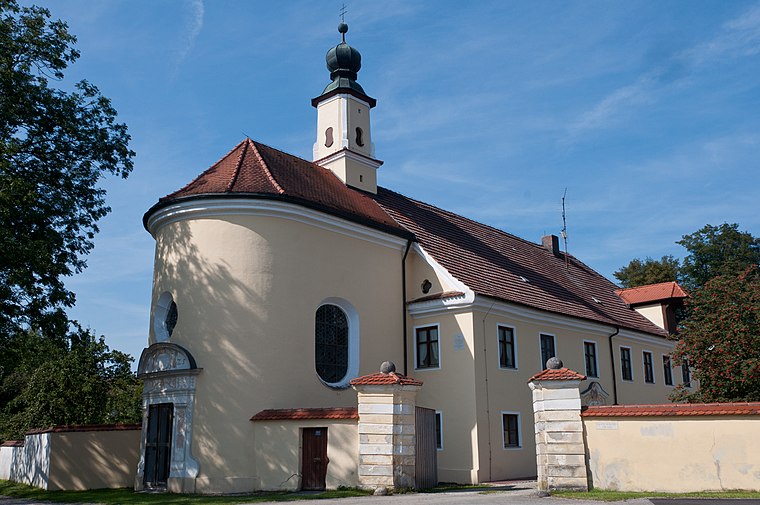
Photo: Mathias Plonka, CC BY-SA 3.0.
Schloss Piflas (Ergolding) is a castle, which is situated 620 metres southeast of Andreas Hangl.
Gymnasium Ergolding
School

Photo: Wikimedia, CC BY-SA 3.0.
Gymnasium Ergolding is a school, which is situated 1 km northeast of Andreas Hangl.
Places in the Area
Nearby places include Schönbrunn and Landshut.

Landshut

Photo: Tbp386, CC BY-SA 3.0.
Landshut is the capital and the biggest city of Lower Bavaria in the German federal state of Bavaria. The city is best known for the Landshut Wedding, a quadrennial re-enactment of the actual medieval wedding, including knights' tournaments.
Achdorf
Suburb

Photo: Helmlechner, CC BY-SA 3.0.
Achdorf is a suburb, which is situated 4½ km southwest of Andreas Hangl.
Andreas Hangl
- Type: Health care
- Address: Wiesenstraße 1 b
- Location: Ergolding, Landshut, Lower Bavaria, Bavaria, Germany, Central Europe, Europe
- View on OpenStreetMap
Latitude
48.55834° or 48° 33′ 30″ northLongitude
12.164° or 12° 9′ 50″ eastOpen location code
8FWJH557+8JOpenStreetMap ID
node 13123474890OpenStreetMap feature
healthcare=alternative
This page is based on OpenStreetMap, Wikidata, and Wikimedia Commons.
We’d love your help improving our open data sources. Thank you for contributing.
Satellite Map
Discover Andreas Hangl from above in high-definition satellite imagery.
Notable Places Nearby
Highlights include Peak7 and Feuerwehr Piflas.
Nearby Places
Explore places such as Hangl & Fischer and Bollywood.
Lower Bavaria: Must-Visit Destinations
Delve into Passau, Landshut, Straubing, and Deggendorf.
Curious Places to Discover
Uncover intriguing places from every corner of the globe.
About Mapcarta. Data © OpenStreetMap contributors and available under the Open Database License". Text is available under the CC BY-SA 4.0 license, except for photos, directions, and the map. Photo: Wikimedia, CC0.