Sankt Bartlmä
Sankt Bartlmä is a church in Techelsberg am Wörther See, Klagenfurt-Land District, Carinthia. Sankt Bartlmä is situated nearby to the peak Hoher Gallin, as well as near Stallhofener Berg.| Tap on a place to explore it |
Places of Interest Nearby
Highlights include Hoher Gallin and Pfarrkirche Hl. Martin.

Pfarrkirche Hl. Martin
Church

Photo: Johann Jaritz, CC BY-SA 4.0.
Pfarrkirche Hl. Martin is a church, which is situated 2 km southwest of Sankt Bartlmä.
Cemetery St. Martin am Techelsberg
Cemetery

Photo: Naturpuur, CC BY-SA 4.0.
Cemetery St. Martin am Techelsberg is situated 2 km southwest of Sankt Bartlmä.
Places in the Area
Nearby places include Pörtschach and Schiefling am Wörthersee.
Pörtschach

Photo: Johann Jaritz, CC BY-SA 3.0 at.
Pörtschach am Wörthersee is a municipality in the district of Klagenfurt-Land in Carinthia, Austria. It is an established summer resort and lakeside town on Wörthersee.
Schiefling am Wörthersee
Village
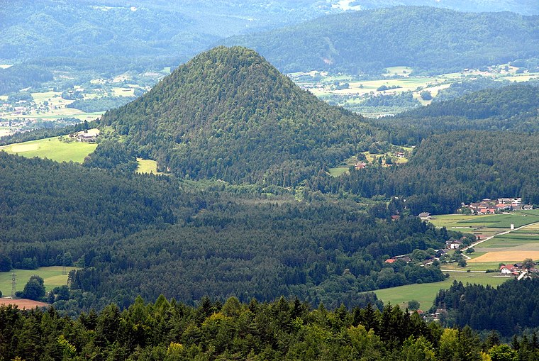
Photo: Johann Jaritz, CC BY-SA 3.0 at.
Schiefling am Wörthersee is a market town in the district of Klagenfurt-Land in the Austrian state of Carinthia. Schiefling am Wörthersee is situated 6 km south of Sankt Bartlmä.
Tiffen
Village

Photo: Rollroboter, CC BY-SA 4.0.
Tiffen is a cadastral municipality in Steindorf am Ossiacher See, in the district of Feldkirchen in the Austrian state of Carinthia. Tiffen is situated 7 km northwest of Sankt Bartlmä.
Sankt Bartlmä
- Type: Church
- Denomination: Roman Catholic
- Categories: place of worship and religion
- Location: Techelsberg am Wörther See, Klagenfurt-Land District, Carinthia, Austria, Central Europe, Europe
- View on OpenStreetMap
Latitude
46.65957° or 46° 39′ 34″ northLongitude
14.11014° or 14° 6′ 37″ eastOpen location code
8FRPM456+R3OpenStreetMap ID
node 1314542733OpenStreetMap feature
amenity=place_of_worshipOpenStreetMap attribute
denomination=roman_catholic
This page is based on OpenStreetMap, Wikidata, and Wikimedia Commons.
We’d love your help improving our open data sources. Thank you for contributing.
Satellite Map
Discover Sankt Bartlmä from above in high-definition satellite imagery.
Places with the Same Name
Discover other places named “Sankt Bartlmä”.
Notable Places Nearby
Highlights include Hoher Gallin and Stallhofener Berg.
Nearby Places
Explore places such as Gasthaus Messner and St. Bartlmä Ort.
Carinthia: Must-Visit Destinations
Delve into Klagenfurt, Villach, Wörthersee, and Spittal an der Drau.
Curious Churches to Discover
Uncover intriguing churches from every corner of the globe.
About Mapcarta. Data © OpenStreetMap contributors and available under the Open Database License". Text is available under the CC BY-SA 4.0 license, except for photos, directions, and the map. Photo: Wikimedia, CC BY-SA 3.0.