El Dorado High School
El Dorado High School is a school in Township of El Dorado, Union, Arkansas. El Dorado High School is situated nearby to Gethsemane Missionary Baptist Church, as well as near the church El Dorado First Assembly.| Tap on a place to explore it |
Places of Interest Nearby
Highlights include El Dorado Downtown-Stevens Field and Union County Courthouse.
El Dorado Downtown-Stevens Field
Aerodrome
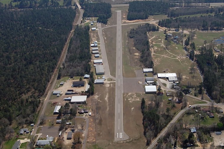
Photo: Wikimedia, Public domain.
Downtown Airport is a city-owned, public-use airport located in El Dorado, a city in Union County, Arkansas, United States. El Dorado Downtown-Stevens Field is situated 2 miles east of El Dorado High School.
Union County Courthouse
Courthouse

Photo: Billy Hathorn, CC BY-SA 3.0.
The Union County Courthouse is a courthouse in El Dorado, Arkansas, United States, the county seat of Union County, built in 1927. It was listed on the National Register of Historic Places in 1983. Union County Courthouse is situated 2 miles northeast of El Dorado High School.
El Dorado Confederate Monument
Memorial
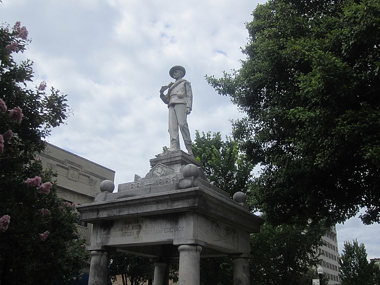
Photo: Billy Hathorn, Public domain.
The El Dorado Confederate Monument is located on the grounds of the Union County Courthouse in El Dorado, Arkansas, near the corner of North Main and South Washington Streets. El Dorado Confederate Monument is situated 2 miles northeast of El Dorado High School.
Places in the Area
Nearby places include El Dorado.
El Dorado

Photo: Photolitherland, CC BY-SA 3.0.
El Dorado is a city in and the county seat of Union County, on the southern border of Arkansas, United States. According to the 2020 census, the population of the city is 17,755.
El Dorado High School
- Type: School
- Category: education
- Location: Township of El Dorado, Union, Arkansas, South, United States, North America
- View on OpenStreetMap
Latitude
33.19998° or 33° 11′ 60″ northLongitude
-92.69377° or 92° 41′ 38″ westOpen location code
865958X4+XFOpenStreetMap ID
node 13151018994OpenStreetMap feature
amenity=school
This page is based on OpenStreetMap, Wikidata, and Wikimedia Commons.
We’d love your help improving our open data sources. Thank you for contributing.
Satellite Map
Discover El Dorado High School from above in high-definition satellite imagery.
Places with the Same Name
Discover other places named “El Dorado High School”.
Notable Places Nearby
Highlights include Gethsemane Missionary Baptist Church and El Dorado First Assembly.
Nearby Places
Explore places such as Subway and El Dorado East Substation.
Arkansas: Must-Visit Destinations
Delve into Little Rock, Fayetteville, Fort Smith, and Jonesboro.
Curious Places to Discover
Uncover intriguing places from every corner of the globe.
About Mapcarta. Data © OpenStreetMap contributors and available under the Open Database License". Text is available under the CC BY-SA 4.0 license, except for photos, directions, and the map. Photo: Wikimedia, CC0.