Sammy’s Snack Bar
Sammy’s Snack Bar is a café in Il-Marsa, Malta. Sammy’s Snack Bar is situated nearby to the school Saint Augustine’s College, as well as near the government office Identita‘.| Tap on a place to explore it |
Places of Interest Nearby
Highlights include Holy Trinity Church and Ħal Saflieni Hypogeum.
Holy Trinity Church
Church

Photo: Brian Harrington Spier, CC BY-SA 2.0.
The Church of the Holy Trinity or simply Trinity Church is a Roman Catholic Parish church located in Marsa, Malta. Holy Trinity Church is situated 280 metres north of Sammy’s Snack Bar.
Ħal Saflieni Hypogeum
Museum

Photo: Wikimedia, CC BY-SA 3.0.
The Hypogeum of Ħal Saflieni is a Neolithic subterranean structure dating to the Saflieni phase in Maltese prehistory, located in Paola, Malta. It is often simply referred to as the Hypogeum, literally meaning "underground" in Greek. Ħal Saflieni Hypogeum is situated 1½ km southeast of Sammy’s Snack Bar.
Saint Augustine’s College
School
St Augustine College in Malta was established as a faith school for boys by the Order of Saint Augustine in 1848 by Gaetano Pace dei Baroni Forno. He founded it in Valletta next door to the church of St. Saint Augustine’s College is situated 230 metres northwest of Sammy’s Snack Bar.
Places in the Area
Nearby places include Marsa and Blata l-Bajda.
Marsa
Village
Photo: Brian Harrington Spier, CC BY-SA 2.0.
Marsa is a town in the Southern Region of Malta, with a population of 4,401 people as of March 2014. The name Marsa means "the harbour".
Blata l-Bajda
Locality

Photo: Wikimedia, Public domain.
Hamrun is a town in the Southern Region of Malta, with a population of 9,244 as of March 2014.
Paola
Town
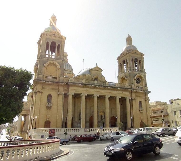
Photo: Sudika, CC BY-SA 3.0.
Paola is a town in the Port Region of Malta, with 8,706 inhabitants as of 2019. The town is a commercial centre in the Southern Harbour area of Malta, about 5 km from the capital Valletta, contiguous to Tarxien and Fgura, with which it forms a single urban area.
Sammy’s Snack Bar
- Type: Café
- Location: Il-Marsa, Malta, Europe
- View on OpenStreetMap
Latitude
35.88038° or 35° 52′ 49″ northLongitude
14.49517° or 14° 29′ 43″ eastOpen location code
8F7PVFJW+53OpenStreetMap ID
node 13154043506OpenStreetMap feature
amenity=cafe
This page is based on OpenStreetMap, Wikidata, and Wikimedia Commons.
We’d love your help improving our open data sources. Thank you for contributing.
Satellite Map
Discover Sammy’s Snack Bar from above in high-definition satellite imagery.
Notable Places Nearby
Highlights include Identita‘ and Kingdom Hall of Jehovah’s Witnesses.
Nearby Places
Explore places such as GARD Group and A. A. K. Grech Brothers.
Malta: Must-Visit Destinations
Delve into Valletta, Mdina, Sliema, and Victoria.
Curious Cafés to Discover
Uncover intriguing cafés from every corner of the globe.
About Mapcarta. Data © OpenStreetMap contributors and available under the Open Database License". Text is available under the CC BY-SA 4.0 license, except for photos, directions, and the map. Photo: Dirk.heldmaier, CC BY-SA 3.0.