Handy ambulance
Handy ambulance is a mobile phone shop in Lustenau, Dornbirn District, Vorarlberg. Handy ambulance is situated nearby to the post office Postamt Lustenau - Rheindorf, as well as near the community center Offene Jugendarbeit Lustenau.| Tap on a place to explore it |
Places of Interest Nearby
Highlights include Redeemer Church and Lorettokapelle.
Redeemer Church
Church

Photo: Wikimedia, CC BY-SA 2.5.
Redeemer Church is situated 210 metres south of Handy ambulance.
Lorettokapelle
Church

Photo: Wikimedia, Public domain.
Lorettokapelle is a church, which is situated 510 metres east of Handy ambulance.
Au SG railway station
Railway station
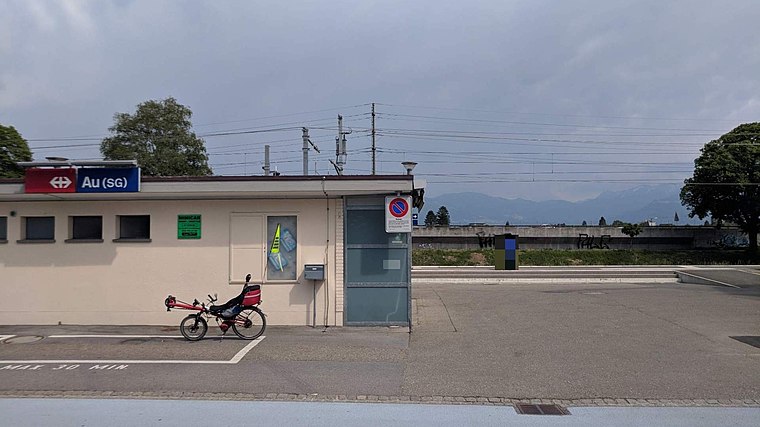
Photo: Wikimedia, Public domain.
Au SG railway station is a railway station in Au, in the Swiss canton of St. Gallen. It is an intermediate stop on the Chur–Rorschach line. Au SG railway station is situated 1 km west of Handy ambulance.
Places in the Area
Nearby places include Lustenau and Au.
Lustenau
Town

Photo: Wikimedia, Public domain.
Lustenau is a town in the westernmost Austrian state of Vorarlberg in the district of Dornbirn. It lies on the river Rhine, which forms the border with Switzerland. Lustenau is Vorarlberg's fourth largest town.
Au
Village

Photo: DidiWeidmann, CC BY-SA 3.0.
Au is a municipality in the Wahlkreis of Rheintal in the canton of St. Gallen in Switzerland.

Handy ambulance
- Type: Mobile phone shop
- Category: shop
- Location: Lustenau, Dornbirn District, Vorarlberg, Austria, Central Europe, Europe
- View on OpenStreetMap
Latitude
47.4372° or 47° 26′ 14″ northLongitude
9.6561° or 9° 39′ 22″ eastOpen location code
8FVFCMP4+VCOpenStreetMap ID
node 13176544618OpenStreetMap feature
shop=mobile_phone
This page is based on OpenStreetMap, Wikidata, and Wikimedia Commons.
We’d love your help improving our open data sources. Thank you for contributing.
Satellite Map
Discover Handy ambulance from above in high-definition satellite imagery.
Notable Places Nearby
Highlights include Postamt Lustenau - Rheindorf and Offene Jugendarbeit Lustenau.
Nearby Places
Explore places such as Dornbirner Sparkasse and Dr. Stella Maria Bonschak und Dr. Michael Schedler.
Vorarlberg: Must-Visit Destinations
Delve into Bregenz, Dornbirn, Feldkirch, and Bludenz.
Curious Mobile Phone Shops to Discover
Uncover intriguing mobile phone shops from every corner of the globe.
About Mapcarta. Data © OpenStreetMap contributors and available under the Open Database License". Text is available under the CC BY-SA 4.0 license, except for photos, directions, and the map. Photo: Böhringer, CC BY-SA 2.5.