La Harangère
La Harangère is a farm in Le Mesnil-sur-Blangy, Arrondissement of Lisieux, Normandy. La Harangère is situated nearby to the building Château de Morainville, as well as near the peak Mont Broult.| Tap on a place to explore it |
Places of Interest Nearby
Highlights include Église Notre-Dame du Mesnil-sur-Blangy and Manoir.
Église Notre-Dame du Mesnil-sur-Blangy
Church

Photo: Ikmo-ned, CC BY-SA 4.0.
Église Notre-Dame du Mesnil-sur-Blangy is a church, which is situated 1¼ km west of La Harangère.
Manoir
Castle

Photo: Ikmo-ned, CC BY-SA 4.0.
Manoir is a castle, which is situated 1½ km south of La Harangère.
Église Notre-Dame de Blangy-le-Château
Church

Photo: Pimprenel, CC BY-SA 3.0.
Église Notre-Dame de Blangy-le-Château is a church, which is situated 1½ km south of La Harangère.
Places in the Area
Nearby places include Manneville-la-Pipard and Fierville-les-Parcs.
Manneville-la-Pipard
Village

Photo: ArséniureDeGallium, CC BY-SA 3.0.
Manneville-la-Pipard is a commune in the Calvados department in the Normandy region in northwestern France. Manneville-la-Pipard is situated 4 km west of La Harangère.
Fierville-les-Parcs
Village

Photo: Ikmo-ned, CC BY-SA 4.0.
Fierville-les-Parcs is a commune in the Calvados department. It's situated in the Normandy region of northwestern France. Fierville-les-Parcs is situated 4 km southwest of La Harangère.
Saint-Julien-sur-Calonne
Village
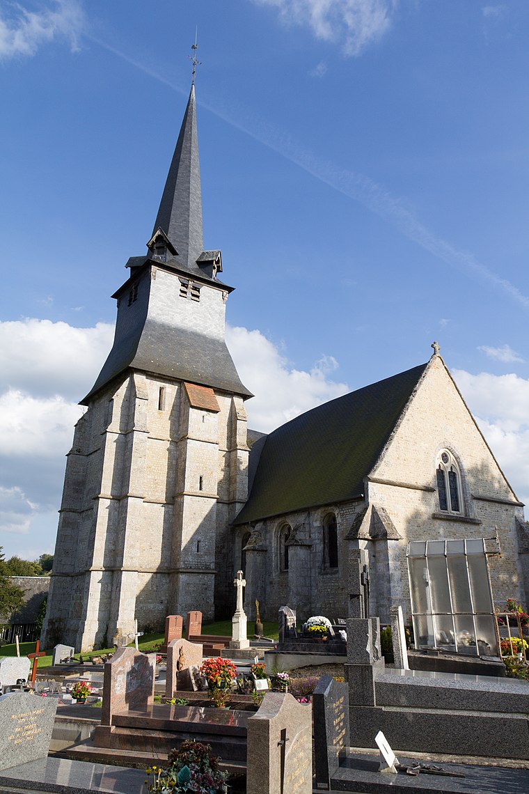
Photo: EdouardHue, CC BY-SA 3.0.
Saint-Julien-sur-Calonne is a commune in the Calvados department in the Normandy region in northwestern France. Saint-Julien-sur-Calonne is situated 5 km northwest of La Harangère.
La Harangère
- Type: Farm
- Categories: locality and agriculture
- Location: Le Mesnil-sur-Blangy, Arrondissement of Lisieux, Calvados, Normandy, France, Europe
- View on OpenStreetMap
Latitude
49.25977° or 49° 15′ 35″ northLongitude
0.27663° or 0° 16′ 36″ eastOpen location code
8FX2775G+WMOpenStreetMap ID
node 13182743751OpenStreetMap feature
place=farm
This page is based on OpenStreetMap, Wikidata, and Wikimedia Commons.
We’d love your help improving our open data sources. Thank you for contributing.
Satellite Map
Discover La Harangère from above in high-definition satellite imagery.
Places with the Same Name
Discover other places named “La Harangère”.
Notable Places Nearby
Highlights include Château de Morainville and Mairie du Mesnil-sur-Blangy.
Nearby Places
Explore places such as La Couyère and La Hucquetière.
Normandy: Must-Visit Destinations
Delve into Orne, Rouen, Seine-Maritime, and Le Havre.
Curious Farms to Discover
Uncover intriguing farms from every corner of the globe.
About Mapcarta. Data © OpenStreetMap contributors and available under the Open Database License". Text is available under the CC BY-SA 4.0 license, except for photos, directions, and the map. Photo: Inkey, CC BY-SA 3.0.