Dr. med. univ. Hermann Maier
Dr. med. univ. Hermann Maier is a doctor’s office in Stephanskirchen, Rosenheim, Bavaria which is located on Salinweg. Dr. med. univ. Hermann Maier is situated nearby to the pitch Spiel- und Bolzplatz, as well as near the government building Bürgerhaus „Rotes Schulhaus“.| Tap on a place to explore it |
- Opening hours: Monday—Friday 8:30 AM—noon and Monday 3:30 PM—5:30 PM and Tuesday 3:30 PM—5:30 PM and Thursday 4:00 PM—7:00 PM and Friday 3:30 PM—5:30 PM
- Type: Doctor’s office
- Address: Salinweg 61b, Stephanskirchen, 83071
Places of Interest Nearby
Highlights include St. Georg and Inn-Museum.
St. Georg
Church

Photo: Rufus46, CC BY-SA 3.0.
St. Georg is a church, which is situated 450 metres northwest of Dr. med. univ. Hermann Maier.
Inn-Museum
Museum

Photo: Mattes, CC BY-SA 2.0.
Inn-Museum is situated 1 km west of Dr. med. univ. Hermann Maier.
Stolperstein dedicated to Johann Vogl
Memorial

Photo: Wikimedia, CC BY-SA 4.0.
Stolperstein dedicated to Johann Vogl is a memorial, which is situated 600 metres west of Dr. med. univ. Hermann Maier.
Places in the Area
Nearby places include Rosenheim and Aising.
Rosenheim

Photo: Helmlechner, CC BY-SA 4.0.
Rosenheim is in the German state of Bavaria. It is south-east of Munich and has a population of 60,000.
Aising
Suburb

Photo: Rufus46, CC BY-SA 3.0.
Aising is a suburb, which is situated 4 km southwest of Dr. med. univ. Hermann Maier.
Riedering
Village
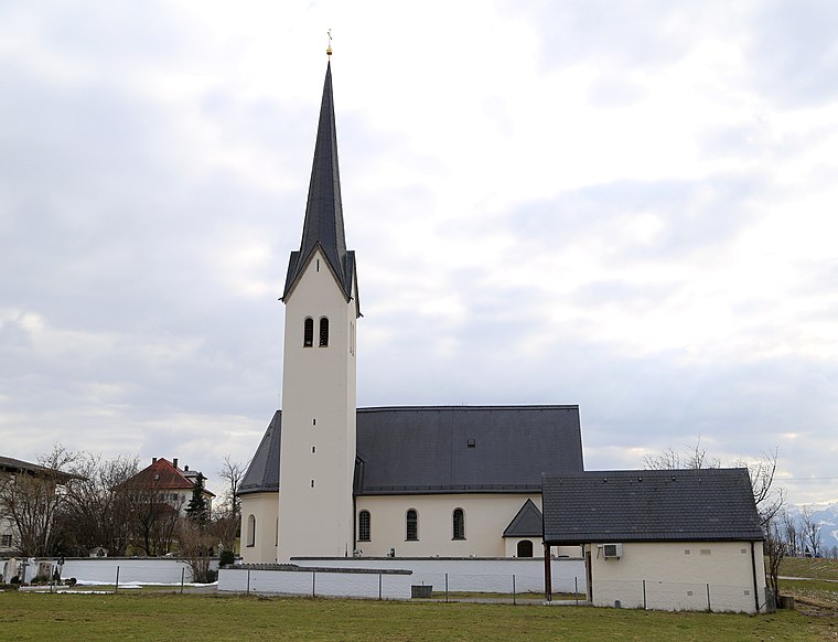
Photo: Rufus46, CC BY-SA 3.0.
Riedering is a municipality in the district of Rosenheim in Bavaria in Germany. Riedering is situated 4½ km southeast of Dr. med. univ. Hermann Maier.
Dr. med. univ. Hermann Maier
- Category: health care
- Location: Stephanskirchen, Rosenheim, Upper Bavaria, Bavaria, Germany, Central Europe, Europe
- View on OpenStreetMap
Latitude
47.85566° or 47° 51′ 20″ northLongitude
12.15287° or 12° 9′ 10″ eastOpen location code
8FVJV543+74OpenStreetMap ID
node 13186153108OpenStreetMap feature
amenity=doctorsOpenStreetMap feature
healthcare=doctor
This page is based on OpenStreetMap, Wikidata, and Wikimedia Commons.
We’d love your help improving our open data sources. Thank you for contributing.
Satellite Map
Discover Dr. med. univ. Hermann Maier from above in high-definition satellite imagery.
Notable Places Nearby
Highlights include Spiel- und Bolzplatz and Bürgerhaus „Rotes Schulhaus“.
Nearby Places
Explore places such as Schloßberg Salinweg/Heubergstraße and Cafe Altbacken.
Upper Bavaria: Must-Visit Destinations
Delve into Munich, Ingolstadt, Rosenheim, and Dachau.
Curious Doctor’s Offices to Discover
Uncover intriguing doctor’s offices from every corner of the globe.
About Mapcarta. Data © OpenStreetMap contributors and available under the Open Database License". Text is available under the CC BY-SA 4.0 license, except for photos, directions, and the map. Photo: Aconcagua, CC BY-SA 3.0.