HIPS
HIPS is a clinic in Washington, D.C., Mid-Atlantic which is located on H Street Northeast. HIPS is situated nearby to the health club Solidcore, as well as near the arts center DC Creative Institute.| Tap on a place to explore it |
- Opening hours: 10:00 AM—5:00 PM
- Type: Clinic
- Address: 906 H Street Northeast, Washington, DC 20002
Places of Interest Nearby
Highlights include United States Capitol and Union Station.
United States Capitol
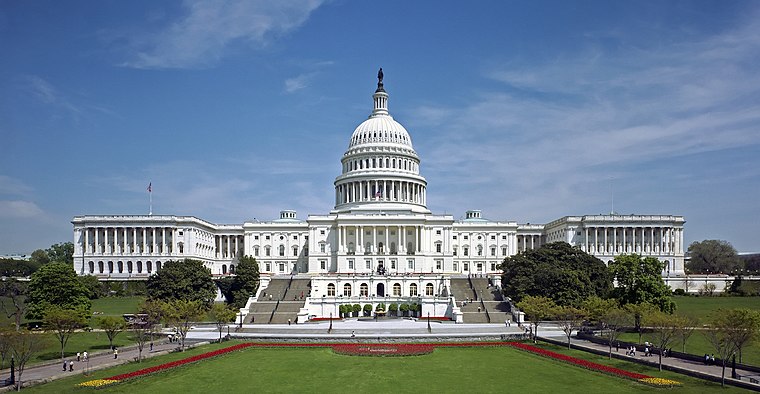
Photo: Ottojula, Public domain.
The United States Capitol, often called the Capitol or the Capitol Building, is the seat of the United States Congress, the legislative branch of the federal government. United States Capitol is situated 1 mile southwest of HIPS.
Union Station

Photo: VeggieGarden, CC BY-SA 4.0.
Washington Union Station, known locally as Union Station, is a major train station, transportation hub, and leisure destination in Washington, D.C. Designed by Daniel Burnham and opened in 1907, it is Amtrak's second-busiest station and North America's 13th-busiest railroad station. Union Station is situated 3,800 feet west of HIPS.
National Postal Museum
Museum
 The National Postal Museum, located in Washington, D.C., is the primary postal museum of the United States. It covers large portions of the postal history of the United States and other countries. National Postal Museum is situated 1 mile west of HIPS.
Places in the Area
Nearby places include NoMa and Near Northeast.
NoMa
Neighborhood

Photo: AgnosticPreachersKid, CC BY-SA 3.0.
NoMa is a neighborhood of Washington, D.C., located in Ward 6 of the city. The neighborhood encompasses the region north of Massachusetts Avenue located north and east of Union Station.
Near Northeast

Photo: Wikimedia, Public domain.
Near Northeast refers to the area just north of Capitol Hill and Union Station, but south of Brookland.
Capitol Hill

Photo: Diliff, CC BY-SA 2.5.
Capitol Hill is a venerable neighborhood just east of the Capitol building, best known as the main residence in the city for the legislative and judicial branches of the U.S. government, and for the staffers who run the place.
HIPS
- Categories: health care, voluntary association, and office
- Location: Washington, D.C., Mid-Atlantic, United States, North America
- View on OpenStreetMap
Latitude
38.90037° or 38° 54′ 1″ northLongitude
-76.99335° or 76° 59′ 36″ westOpen location code
87C5W224+4MOpenStreetMap ID
node 13202590515OpenStreetMap feature
amenity=clinicOpenStreetMap feature
healthcare=clinicOpenStreetMap feature
office=association
This page is based on OpenStreetMap, Wikidata, and Wikimedia Commons.
We’d love your help improving our open data sources. Thank you for contributing.
Satellite Map
Discover HIPS from above in high-definition satellite imagery.
Places with the Same Name
Discover other places named “HIPS”.
Notable Places Nearby
Highlights include Solidcore and DC Creative Institute.
Nearby Places
Explore places such as Paste & Rind Cheese Co. and Boost Mobile.
Washington, D.C.: Must-Visit Destinations
Delve into West End, East End, Georgetown, and Shaw.
Curious Clinics to Discover
Uncover intriguing clinics from every corner of the globe.
About Mapcarta. Data © OpenStreetMap contributors and available under the Open Database License". Text is available under the CC BY-SA 4.0 license, except for photos, directions, and the map. Photo: Peterfitzgerald, CC BY-SA 3.0.