中共河西区天塔街道宾水西里社区委员会
中共河西区天塔街道宾水西里社区委员会 is a community center in Tianjin Municipality, Tianjin. 中共河西区天塔街道宾水西里社区委员会 is situated nearby to the government office 天津市河西区环境卫生管理第四队, as well as near the fire station 河西区体院北道消防救援站.| Tap on a place to explore it |
Places of Interest Nearby
Highlights include Tianjin Olympic Centre Stadium and Tianjin Radio and Television Tower.
Tianjin Olympic Centre Stadium
Stadium

Photo: Bill Benson, CC BY 2.0.
The Tianjin Olympic Centre, often colloquially referred to as the Water Drop, is a sports complex with a multi-use stadium named Tianjin Olympic Centre Stadium in Tianjin, China. Tianjin Olympic Centre Stadium is situated 1½ km southwest of 中共河西区天塔街道宾水西里社区委员会.
Tianjin Radio and Television Tower
Public building
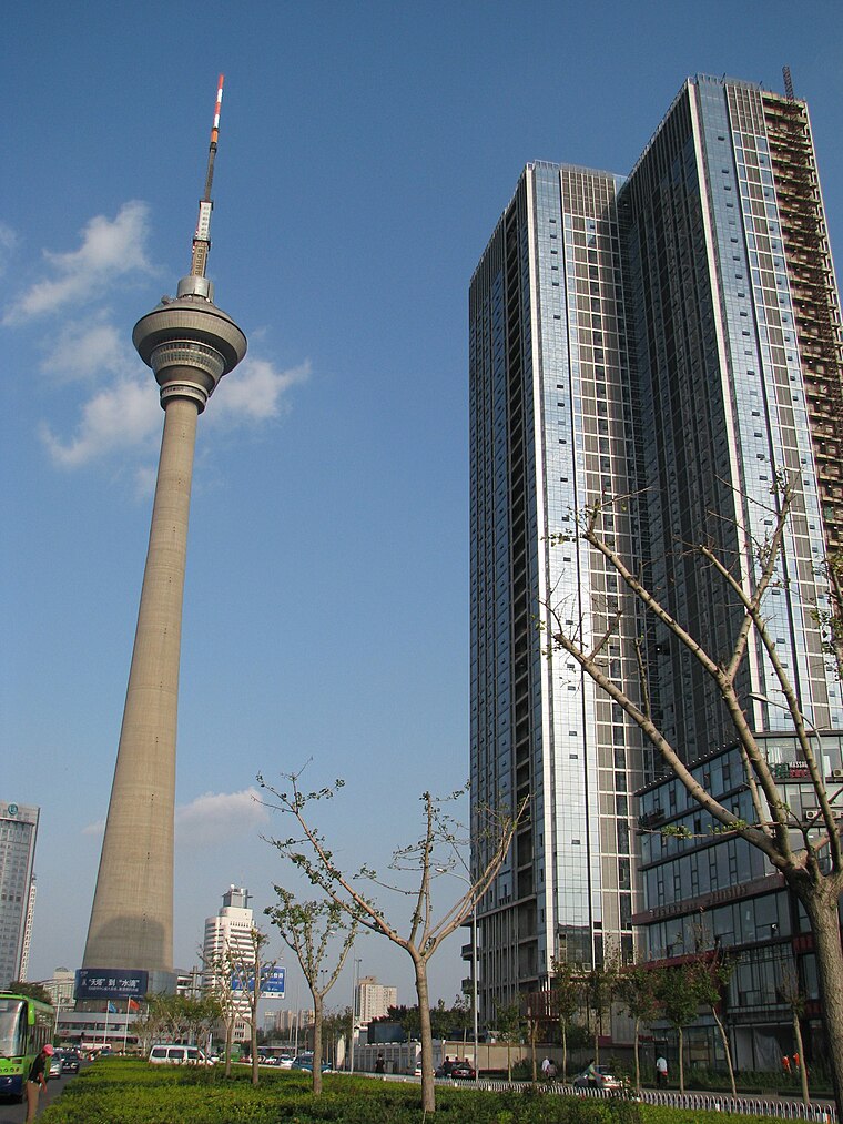
Photo: Netopyr-e, CC BY-SA 3.0.
The Tianjin Radio and Television Tower is a 415.2-meter-tall tower in Tianjin, China, used primarily for communication. It is the 8th tallest freestanding tower in the world. Tianjin Radio and Television Tower is situated 1½ km northwest of 中共河西区天塔街道宾水西里社区委员会.
Tianjin Arena
Stadium
 Tianjin Arena is an indoor sporting arena located in Tianjin Sports Center, Tianjin, China. The capacity of the arena is 10,000 spectators. The arena is used to host indoor sporting events, such as basketball and volleyball. Tianjin Arena is situated 1 km west of 中共河西区天塔街道宾水西里社区委员会.
Places in the Area
Nearby places include Suburban and Rural Districts and Central Districts.
Suburban and Rural Districts

Photo: Matthew Summerton, CC BY-SA 3.0.
The suburban and rural districts of Tianjin include Baodi District, Beichen District, Dongli District, Jinghai District, Jinnan District, Ninghe District, Wuqing District and Xiqing District.
Central Districts

Photo: Codas, CC BY-SA 4.0.
The central districts of Tianjin include Hebei District, Hedong District, Heping District, Hexi District, Hongqiao District and Nankai District.
Jingwu
Town
Jingwu Town is one of the seven towns in Xiqing District, Tianjin, China. It borders Xiyingmen and Huayuan Subdistricts to the north, Liqizhuang Subdistrict and Dasi Town to the east, Tuanbo Town and Yangchengzhuang Township to the south, and Zhangjiawo Town to the west. Jingwu is situated 8 km southwest of 中共河西区天塔街道宾水西里社区委员会.
中共河西区天塔街道宾水西里社区委员会
- Type: Community center
- Location: Tianjin Municipality, Tianjin, North China, China, East Asia, Asia
- View on OpenStreetMap
Latitude
39.079° or 39° 4′ 44″ northLongitude
117.18423° or 117° 11′ 3″ eastOpen location code
8PFV35HM+JMOpenStreetMap ID
node 13232115224OpenStreetMap feature
amenity=community_centre
This page is based on OpenStreetMap, Wikidata, and Wikimedia Commons.
We’d love your help improving our open data sources. Thank you for contributing.
Satellite Map
Discover 中共河西区天塔街道宾水西里社区委员会 from above in high-definition satellite imagery.
Notable Places Nearby
Highlights include 天津市河西区环境卫生管理第四队 and 河西区体院北道消防救援站.
Nearby Places
Explore places such as 宾水西里 and 天津市河西区第二十六幼儿园.
Tianjin: Must-Visit Destinations
Delve into Central Districts, Binhai, Jizhou, and Suburban and Rural Districts.
Curious Community Centers to Discover
Uncover intriguing community centers from every corner of the globe.
About Mapcarta. Data © OpenStreetMap contributors and available under the Open Database License". Text is available under the CC BY-SA 4.0 license, except for photos, directions, and the map. Photo: Willwongprd, CC BY-SA 4.0.