Heeresberg
Heeresberg is a peak in Gera, Thuringia. Heeresberg is situated nearby to the quarter Oberröppisch, as well as near Unterröppisch.| Tap on a place to explore it |
Places of Interest
Highlights include Fuchs-Tower and St. Martini (Zwötzen).

St. Martini (Zwötzen)
Church
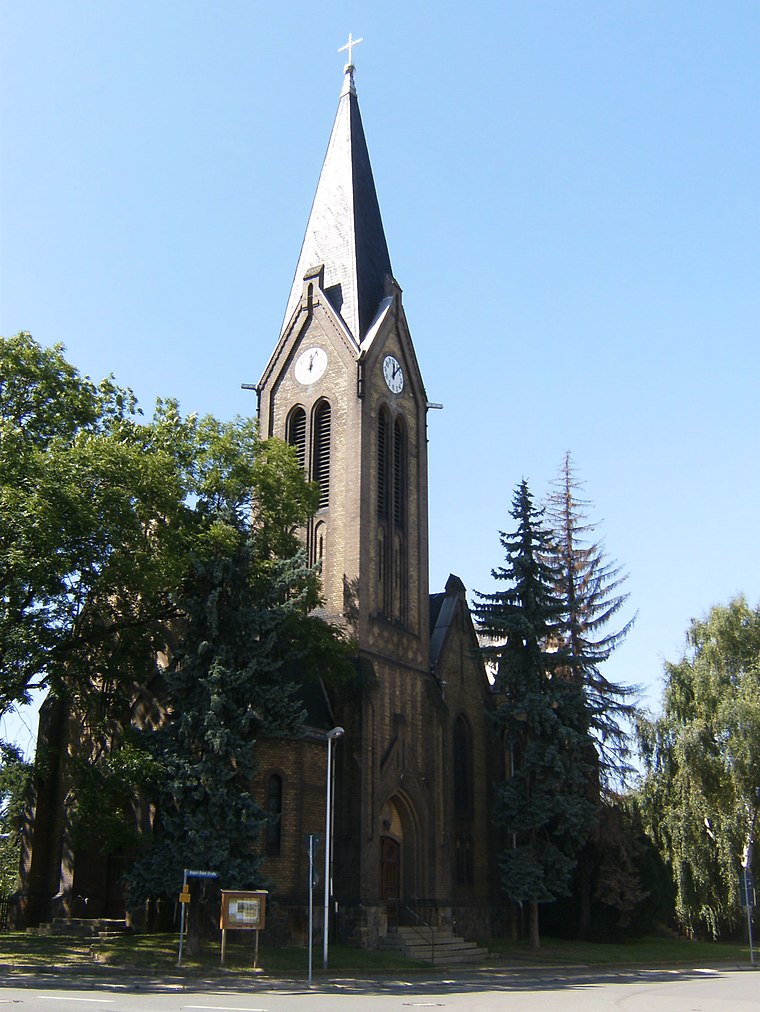
Photo: Christine Türpitz, CC BY 3.0.
St. Martini (Zwötzen) is a church.
Dorfkirche Oberröppisch
Church

Photo: Christine Türpitz, CC BY 3.0.
Dorfkirche Oberröppisch is a church.
Places in the Area
Nearby places include Lusan and Zedlitz.
Zedlitz
Village

Photo: Lucas Friese, CC BY-SA 3.0.
Zedlitz is a municipality in the district of Greiz, in Thuringia, Germany. The town has a municipal association with Münchenbernsdorf.
Kauern
Village

Photo: Lucas Friese, CC BY-SA 3.0.
Kauern is a German municipality in the Thuringian Landkreis of Greiz. It belongs to the Verwaltungsgemeinschaft of Ländereck.
Heeresberg
- Type: Peak
- Category: landform
- Location: Gera, Thuringia, Germany, Central Europe, Europe
- View on OpenStreetMap
Latitude
50.838° or 50° 50′ 17″ northLongitude
12.0728° or 12° 4′ 22″ eastOpen location code
9F2JR3QF+54OpenStreetMap ID
node 1323821077OpenStreetMap feature
natural=peak
This page is based on OpenStreetMap, Wikidata, and Wikimedia Commons.
We’d love your help improving our open data sources. Thank you for contributing.
Satellite Map
Discover Heeresberg from above in high-definition satellite imagery.
Localities in the Area
Explore places such as Oberröppisch and Röppisch.
Notable Places Nearby
Highlights include Moutainbikebahn Gera Lusan and space.
Thuringia: Must-Visit Destinations
Delve into Erfurt, Weimar, Jena, and Eisenach.
Curious Peaks to Discover
Uncover intriguing peaks from every corner of the globe.
About Mapcarta. Data © OpenStreetMap contributors and available under the Open Database License". Text is available under the CC BY-SA 4.0 license, except for photos, directions, and the map. Photo: Taxiarchos228, FAL.