Les Juillards
Les Juillards is in Passy, Arrondissement of Bonneville, Auvergne-Rhône-Alpes and has an elevation of 963 metres. Les Juillards is situated nearby to the church Chapelle de Bay, as well as near the town Passy.| Tap on a place to explore it |
Places of Interest Nearby
Highlights include Chapelle de Bay and Église Saint-Pierre-et-Saint-Paul de Passy.
Chapelle de Bay
Church

Photo: Patrice78500, CC BY-SA 3.0.
Chapelle de Bay is a church, which is situated 490 metres southeast of Les Juillards.
Église Saint-Pierre-et-Saint-Paul de Passy
Church
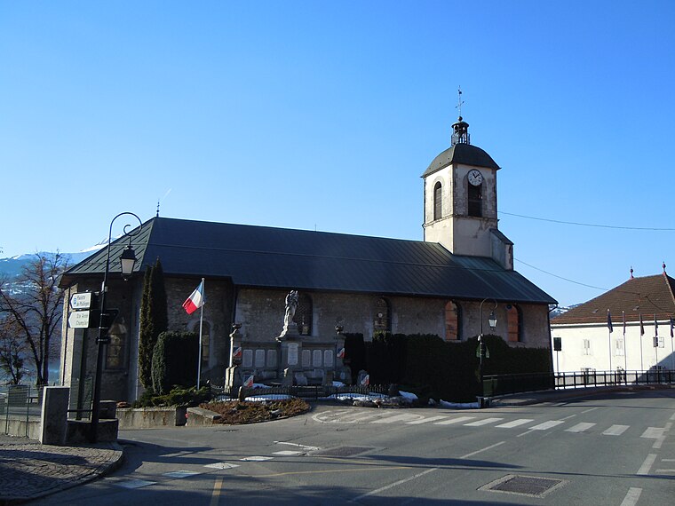
Photo: Patrice78500, CC BY-SA 3.0.
Église Saint-Pierre-et-Saint-Paul de Passy is a church, which is situated 1½ km southeast of Les Juillards.
Refuge de Varan
Mountain hut

Photo: Djailla82, CC BY-SA 4.0.
Refuge de Varan is a mountain hut, which is situated 2 km northeast of Les Juillards.
Places in the Area
Nearby places include Passy and Domancy.
Passy
Town
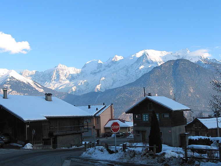
Photo: Jean-Pol GRANDMONT, CC BY 3.0.
Passy is a commune in the Haute-Savoie department in the Auvergne-Rhône-Alpes region in south-eastern France. It is part of the urban area of Sallanches.
Domancy
Village

Photo: Pmau, CC BY-SA 4.0.
Domancy is a commune in the Haute-Savoie department in the Auvergne-Rhône-Alpes region in south-eastern France. It is part of the urban area of Sallanches. Domancy is situated 3 km southwest of Les Juillards.
Sallanches
Town

Photo: Ville de Sallanches, CC BY-SA 4.0.
Sallanches is a commune in the Haute-Savoie department of the Auvergne-Rhône-Alpes region of France. Located close to the Mont Blanc massif, many visitors pass through the town en route to well-known alpine resorts such as Chamonix, Megève and Saint-Gervais-les-Bains. Sallanches is situated 3½ km west of Les Juillards.
Les Juillards
- Type: Sign
- Categories: information and tourism
- Location: Passy, Arrondissement of Bonneville, Haute-Savoie, Auvergne-Rhône-Alpes, France, Europe
- View on OpenStreetMap
Latitude
45.93391° or 45° 56′ 2″ northLongitude
6.67253° or 6° 40′ 21″ eastElevation
963 metres (3,159 feet)Open location code
8FQ8WMMF+H2OpenStreetMap ID
node 13239705341OpenStreetMap feature
tourism=information
This page is based on OpenStreetMap, Wikidata, and Wikimedia Commons.
We’d love your help improving our open data sources. Thank you for contributing.
Satellite Map
Discover Les Juillards from above in high-definition satellite imagery.
Places with the Same Name
Discover other places named “Les Juillards”.
Notable Places Nearby
Highlights include Décollage FFVL de Varan and Aire de Passy Mont-Blanc.
Nearby Places
Explore places such as Bay (Le Parchet) and Le Parchet.
Haute-Savoie: Must-Visit Destinations
Delve into Chamonix, Annecy, Annemasse, and Evian.
Curious Places to Discover
Uncover intriguing places from every corner of the globe.
About Mapcarta. Data © OpenStreetMap contributors and available under the Open Database License". Text is available under the CC BY-SA 4.0 license, except for photos, directions, and the map. Photo: Ypsilon from Finland, CC0.