Friends of Ruby
Friends of Ruby is a social service facility in Old Toronto, Toronto, Ontario which is located on Dundas Street East. Friends of Ruby is situated nearby to All Saints Church, as well as near the building Seaton House.| Tap on a place to explore it |
Places of Interest Nearby
Highlights include Yonge-Dundas and St. Michael’s Cathedral Basilica.
Yonge-Dundas

Photo: Benson Kua, CC BY-SA 2.0.
Yonge-Dundas is the very heart of downtown Toronto—in more ways than one. After all, the major arterials of Yonge Street and Dundas St meet here, and the resulting intersection may be the city's busiest.
St. Michael’s Cathedral Basilica
Church

Photo: Montrealais, CC BY-SA 3.0.
St. Michael's Cathedral Basilica is the cathedral church of the Roman Catholic Archdiocese of Toronto, Canada, and one of the oldest churches in Toronto. St. Michael’s Cathedral Basilica is situated 520 metres southwest of Friends of Ruby.
Toronto Eaton Centre
Shopping center
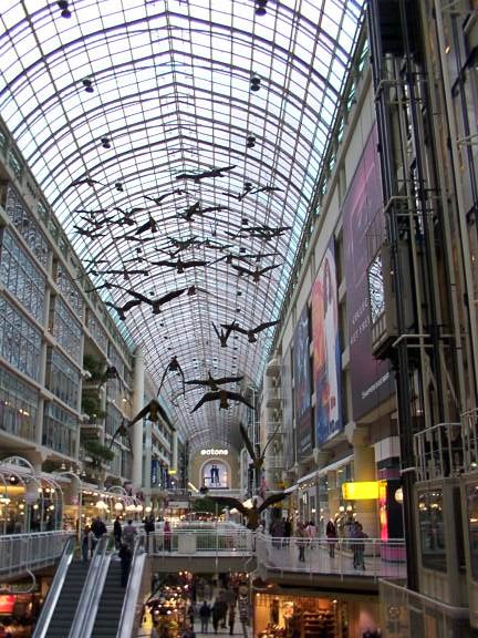
Photo: Wikimedia, CC BY-SA 3.0.
The CF Toronto Eaton Centre, commonly referred to simply as the Eaton Centre, is a shopping mall and office complex in the downtown core of Toronto, Ontario, Canada. Toronto Eaton Centre is situated 1 km southwest of Friends of Ruby.
Places in the Area
Nearby places include Moss Park and Garden District.
Moss Park
Neighborhood

Photo: GTD Aquitaine, Public domain.
Moss Park is a residential neighbourhood located in downtown Toronto, Ontario, Canada. The area known as Moss Park is typically considered to be between Jarvis Street and Parliament Street, south of Dundas Street and North of Queen Street, an area dominated by public housing projects.
Garden District
Neighborhood

Photo: Luke Hollins, CC BY-SA 2.0.
The Garden District is a neighbourhood in downtown Toronto, Ontario, Canada. The name was selected by the Toronto East Downtown Residents Association in recognition of Allan Gardens, an indoor botanical garden located nearby at the intersection of Carlton and Jarvis Streets.
Downtown East

Photo: Traveler100, CC BY-SA 3.0.
The Downtown East of Toronto covers an area south of Bloor Street roughly between Yonge Street and the Don River. Most points of interest are clustered either in the north or south ends of this district.
Friends of Ruby
- Type: Social service facility
- Address: 257 Dundas Street East
- Location: Old Toronto, Toronto, Greater Toronto Area, Ontario, Canada, North America
- View on OpenStreetMap
Latitude
43.65801° or 43° 39′ 29″ northLongitude
-79.3721° or 79° 22′ 20″ westOpen location code
87M2MJ5H+65OpenStreetMap ID
node 13246870365OpenStreetMap feature
amenity=social_facility
This page is based on OpenStreetMap, Wikidata, and Wikimedia Commons.
We’d love your help improving our open data sources. Thank you for contributing.
Satellite Map
Discover Friends of Ruby from above in high-definition satellite imagery.
Notable Places Nearby
Highlights include All Saints Church and Seaton House.
Nearby Places
Explore places such as Sector 17 and Dundas St E / Pembroke St.
Toronto: Must-Visit Destinations
Delve into Yorkville and the Annex, Midtown, East End, and Downtown East.
Curious Social Service Facilities to Discover
Uncover intriguing social service facilities from every corner of the globe.
About Mapcarta. Data © OpenStreetMap contributors and available under the Open Database License". Text is available under the CC BY-SA 4.0 license, except for photos, directions, and the map. Photo: S23678, CC BY-SA 3.0.