Ruines d de la Madeleine
Ruines d de la Madeleine is a ruins in Malestroit, Arrondissement of Vannes, Brittany. Ruines d de la Madeleine is situated nearby to the church Chapel of the Madeleine, Malestroit, as well as near the community center Salle des Fêtes.| Tap on a place to explore it |
Places of Interest Nearby
Highlights include Chapel of the Madeleine, Malestroit and Église Saint-Gilles de Malestroit.
Chapel of the Madeleine, Malestroit
Church

Photo: Alexandre Bloch, Public domain.
The Chapel of the Madeleine, formerly the Priory of the Madeleine or Malestroit Priory, is a ruined chapel in Malestroit in the department of Morbihan, Brittany, France.
Église Saint-Gilles de Malestroit
Church
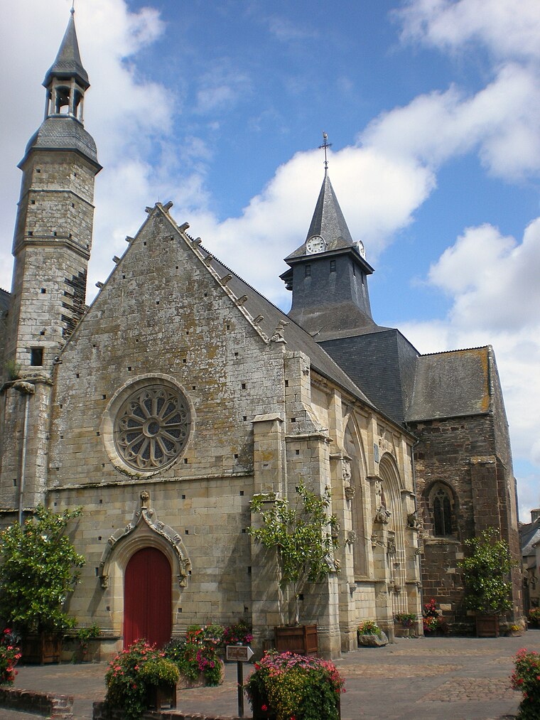
Photo: Guillaume de clermont 60, CC BY-SA 3.0.
Église Saint-Gilles de Malestroit is a church, which is situated 470 metres southwest of Ruines d de la Madeleine.
Chapelle du couvent des Ursulines de Malestroit
Church

Photo: Fab5669, CC BY-SA 4.0.
Chapelle du couvent des Ursulines de Malestroit is a church, which is situated 500 metres west of Ruines d de la Madeleine.
Places in the Area
Nearby places include Île Notre-Dame and Saint-Marcel.

Saint-Marcel
Village

Photo: Pymouss, CC BY-SA 3.0.
Saint-Marcel is a commune in the Morbihan department of Brittany in north-western France. Saint-Marcel houses the Museum of the Breton Resistance which commemorates the uprising of the Maquis of Saint-Marcel and 200 Free French SAS parachutists in 18 June 1944, which the French force under command of Colonel Morice, Free French Pierre Bourgoin and André Hue came under German attack. Saint-Marcel is situated 3½ km west of Ruines d de la Madeleine.
Saint-Abraham
Village

Photo: Pymouss, CC BY-SA 3.0.
Saint-Abraham is a commune in the Morbihan department of Brittany in north-western France. Saint-Abraham is situated 5 km northwest of Ruines d de la Madeleine.
Ruines d de la Madeleine
- Type: Ruins
- Category: historic site
- Location: Malestroit, Arrondissement of Vannes, Morbihan, Brittany, France, Europe
- View on OpenStreetMap
Latitude
47.81256° or 47° 48′ 45″ northLongitude
-2.37746° or 2° 22′ 39″ westOpen location code
8CVVRJ7F+22OpenStreetMap ID
node 13252354161OpenStreetMap feature
historic=ruins
This page is based on OpenStreetMap, Wikidata, and Wikimedia Commons.
We’d love your help improving our open data sources. Thank you for contributing.
Satellite Map
Discover Ruines d de la Madeleine from above in high-definition satellite imagery.
Notable Places Nearby
Highlights include Salle des Fêtes and Centre d’incendie et de secours de Malestroit.
Nearby Places
Explore places such as Cabinet d’ostéopathie and boin jacky.
Brittany: Must-Visit Destinations
Delve into Rennes, Brest, Finistère, and Morbihan.
Curious Ruins to Discover
Uncover intriguing ruins from every corner of the globe.
About Mapcarta. Data © OpenStreetMap contributors and available under the Open Database License". Text is available under the CC BY-SA 4.0 license, except for photos, directions, and the map. Photo: Spendeau, CC BY-SA 3.0.