Paloaro
Paloaro is a locality in Liminka and surroundings, Oulu, North Ostrobothnia. Paloaro is situated nearby to the locality Mustakuru, as well as near the hamlet Kurranperä.| Tap on a place to explore it |
Places of Interest
Highlights include Liminka Bay Visitor Centre and Rantakylä Chapel.
Liminka Bay Visitor Centre
Ranger station

Photo: Estormiz, Public domain.
Liminka Bay Visitor Centre is a ranger station.

Places in the Area
Nearby places include Lumijoki.
Lumijoki
Town
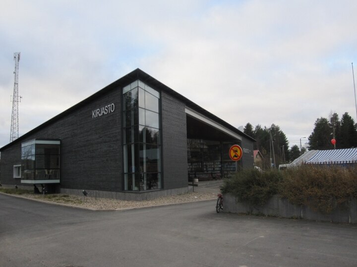
Photo: Ville Siliämaa, CC BY-SA 3.0.
Lumijoki is a municipality of Finland. It is located in the Northern Ostrobothnia region. The municipality has a population of 2,016 and covers an area of 290.29 square kilometres of which 77.1 km2 is water. Lumijoki is situated 7 km northwest of Paloaro.
Paloaro
- Type: Locality
- Location: Liminka and surroundings, Oulu, North Ostrobothnia, Finland, Nordic countries, Europe
- View on OpenStreetMap
Latitude
64.8038° or 64° 48′ 14″ northLongitude
25.30678° or 25° 18′ 24″ eastOpen location code
9GP7R834+GPOpenStreetMap ID
node 13257180129OpenStreetMap feature
place=locality
This page is based on OpenStreetMap, Wikidata, and Wikimedia Commons.
We’d love your help improving our open data sources. Thank you for contributing.
Satellite Map
Discover Paloaro from above in high-definition satellite imagery.
Localities in the Area
Explore places such as Mustakuru and Kurranperä.
Notable Places Nearby
Highlights include Äidinniitty and Kurrankangas.
Finland: Must-Visit Destinations
Delve into Helsinki, Turku, Tampere, and Rovaniemi.
Curious Localities to Discover
Uncover intriguing localities from every corner of the globe.
About Mapcarta. Data © OpenStreetMap contributors and available under the Open Database License". Text is available under the CC BY-SA 4.0 license, except for photos, directions, and the map. Photo: Wikimedia, Public domain.