Cois Gallán
Cois Gallán is a neighborhood in County Cork, Munster. Cois Gallán is situated nearby to the neighborhood Danesfort, as well as near Coppenger Fields.| Tap on a place to explore it |
Places of Interest
Highlights include Cork Kent and Delaney Brothers Monument.
Cork Kent
Railway station
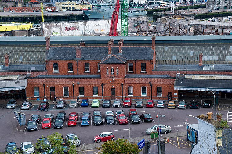
Photo: Jonjobaker, CC BY-SA 4.0.
Kent Station is an Iarnród Éireann railway station in Cork, Ireland. Originally opened in 1893, the station operates as a hub for Intercity services to Dublin and Tralee and commuter services to Mallow, Cobh and Midleton. Cork Kent is situated 3½ km south of Cois Gallán.
Delaney Brothers Monument
Memorial

Photo: Michael O’Sheil, CC BY-SA 4.0.
Delaney Brothers Monument is a memorial.
Cathedral of St Mary and St Anne
Church

Photo: JohnArmagh, Public domain.
The Cathedral of Saint Mary and Saint Anne, also known as Saint Mary's Cathedral, The North Cathedral or The North Chapel, is a Roman Catholic cathedral located at the top of Shandon Street in Cork, Ireland. Cathedral of St Mary and St Anne is situated 3½ km southwest of Cois Gallán.
Places in the Area
Nearby places include Mayfield and Blackpool.
Mayfield
Suburb

Photo: Ceoil, CC BY-SA 3.0.
Mayfield, historically Ballinamought, is a suburb on the north-side of Cork city, Ireland. Mayfield is part of the Dáil constituency of Cork North-Central. Mayfield is situated 2½ km southeast of Cois Gallán.
Blackpool
Suburb

Photo: Sebastian “sebrem” B…, CC BY-SA 3.0.
Blackpool is a suburb of Cork city in County Cork, Ireland. It is situated in the north of the city, on the N20 road to Mallow. Blackpool is part of the Cork North Central Dáil constituency. Blackpool is situated 2½ km southwest of Cois Gallán.
Montenotte
Suburb

Photo: Podstawko, CC BY-SA 4.0.
Montenotte is an area in the northeast of Cork City, Ireland, which was home to merchants and a prosperous middle class from the early to mid-19th century. Montenotte is situated 3 km south of Cois Gallán.
Cois Gallán
- Type: Neighborhood
- Category: locality
- Location: County Cork, Munster, Southwest Ireland, Ireland, Britain and Ireland, Europe
- View on OpenStreetMap
Latitude
51.93101° or 51° 55′ 52″ northLongitude
-8.4545° or 8° 27′ 16″ westOpen location code
9C3HWGJW+C6OpenStreetMap ID
node 13277574970OpenStreetMap feature
place=neighbourhood
This page is based on OpenStreetMap, Wikidata, and Wikimedia Commons.
We’d love your help improving our open data sources. Thank you for contributing.
Satellite Map
Discover Cois Gallán from above in high-definition satellite imagery.
Localities in the Area
Explore places such as Danesfort and Coppenger Fields.
Notable Places Nearby
Highlights include Old Mill and Murphy’s Rock.
County Cork: Must-Visit Destinations
Delve into Cork, Cobh, Kinsale, and Mallow.
Curious Neighborhoods to Discover
Uncover intriguing neighborhoods from every corner of the globe.
About Mapcarta. Data © OpenStreetMap contributors and available under the Open Database License". Text is available under the CC BY-SA 4.0 license, except for photos, directions, and the map. Photo: Wikimedia, CC BY-SA 3.0.