The Global Learning Collaborative
The Global Learning Collaborative is a school in Manhattan, New York which is located on West 84th Street. The Global Learning Collaborative is situated nearby to The Urban Assembly School for Green Careers, as well as near Innovation Diploma Plus High School.| Tap on a place to explore it |
- Type: School
- Description: high school located in the Upper West Side neighborhood of Manhattan
- Address: 145 West 84th Street, New York, NY 10024
- Wheelchair access: yes
Places of Interest Nearby
Highlights include Central Park and American Museum of Natural History.
Central Park

Photo: Ed Yourdon, CC BY-SA 2.0.
A vast green swath of open space in the heart of Manhattan, Central Park is a district in its own right, neatly separating the Upper East Side from the Upper West Side, stretching from Midtown at the southern end to Harlem at the north.
American Museum of Natural History
Museum
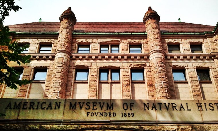
Photo: Gigi alt, CC BY-SA 3.0.
The American Museum of Natural History is a natural history museum on the Upper West Side of Manhattan in New York City. Located in Theodore Roosevelt Park, across the street from Central Park, the museum complex comprises 21 interconnected buildings housing 45 permanent exhibition halls, in addition to a planetarium and a library. American Museum of Natural History is situated 1,800 feet south of The Global Learning Collaborative.
Innovation Diploma Plus High School
School
Innovation Diploma Plus High School is located on 145 West 84th Street within the Upper West Side of Manhattan. It is also one of the four schools that are located in the Louis D. Brandeis High School Campus.
Places in the Area
Nearby places include Upper West Side and Manhattan Valley.
Upper West Side

Photo: Wikimedia, CC BY-SA 3.0.
The Upper West Side covers a large area in upper Manhattan bounded by 59th Street on the south, 125th Street on the north, the Hudson River on the west, and Central Park and Morningside Park on the east.
Manhattan Valley
Neighborhood
Manhattan Valley is a neighborhood in the northern part of the Upper West Side of Manhattan in New York City. It is bounded by West 110th Street to the north, Central Park West to the east, West 96th Street to the south, and Broadway to the west.
Lincoln Square
Neighborhood

Photo: Wikimedia, CC BY-SA 4.0.
Lincoln Square is the name of both a square and the surrounding neighborhood on the Upper West Side of Manhattan in New York City. Lincoln Square is centered on the intersection of Broadway and Columbus Avenue, between West 65th and 66th streets.
The Global Learning Collaborative
- Categories: academic institution and education
- Location: Manhattan, New York, Mid-Atlantic, United States, North America
- View on OpenStreetMap
Latitude
40.78597° or 40° 47′ 10″ northLongitude
-73.97391° or 73° 58′ 26″ westOperator
New York City Public SchoolsOpen location code
87G8Q2PG+9COpenStreetMap ID
node 13278422925OpenStreetMap feature
amenity=schoolOpenStreetMap attribute
wheelchair=yesWikidata ID
Q105286387
This page is based on OpenStreetMap, Wikidata, and Wikimedia Commons.
We’d love your help improving our open data sources. Thank you for contributing.
Satellite Map
Discover The Global Learning Collaborative from above in high-definition satellite imagery.
Notable Places Nearby
Highlights include The Urban Assembly School for Green Careers and Frank McCourt High School.
Nearby Places
Explore places such as Success Academy and Louis D Brandeis High School.
Manhattan: Must-Visit Destinations
Delve into Central Park, Upper East Side, Theater District, and Upper West Side.
Curious Schools to Discover
Uncover intriguing schools from every corner of the globe.
About Mapcarta. Data © OpenStreetMap contributors and available under the Open Database License". Text is available under the CC BY-SA 4.0 license, except for photos, directions, and the map. Photo: Wikimedia, CC BY-SA 3.0.