McKinley Elementary School
McKinley Elementary School is a school in Town of Westfield, Union County, New Jersey which is located on 1st Street. McKinley Elementary School is situated nearby to Saint Luke African Methodist Episcopal Zion Church, as well as near the military installation New Jersey State National Guard Armory.| Tap on a place to explore it |
Places of Interest Nearby
Highlights include Westfield station and Westfield Fire Headquarters.
Westfield station
Railway station

Photo: Wikimedia, CC BY-SA 2.0.
Westfield is a NJ Transit railroad station on the Raritan Valley Line, in Westfield, Union County, New Jersey, United States. Westfield station is situated 2,300 feet northeast of McKinley Elementary School.
Westfield Fire Headquarters
Fire station

Photo: KForce, CC BY-SA 3.0.
Westfield Fire Headquarters is located in Westfield, Union County, New Jersey, United States. The firehouse was built in 1911 and added to the National Register of Historic Places on December 8, 1980. Westfield Fire Headquarters is situated 2,300 feet northeast of McKinley Elementary School.
Roosevelt Intermediate School
School

Photo: Wikimedia, Public domain.
The Westfield Public Schools is a comprehensive community public school district that serves students in pre-kindergarten through twelfth grade from Westfield, in Union County, in the U.S. state of New Jersey. Roosevelt Intermediate School is situated 2,300 feet north of McKinley Elementary School.
Places in the Area
Nearby places include Westfield and Fanwood.
Westfield
Town

Photo: Jared Kofsky, CC BY-SA 3.0.
Westfield is a town in Union County, in the U.S. state of New Jersey, located 16 miles southwest of Manhattan. As of the 2020 United States census, the town's population was 31,032, an increase of 716 from the 2010 census count of 30,316, which in turn reflected an increase of 672 from the 29,644 counted in the 2000 census.
Fanwood
Town
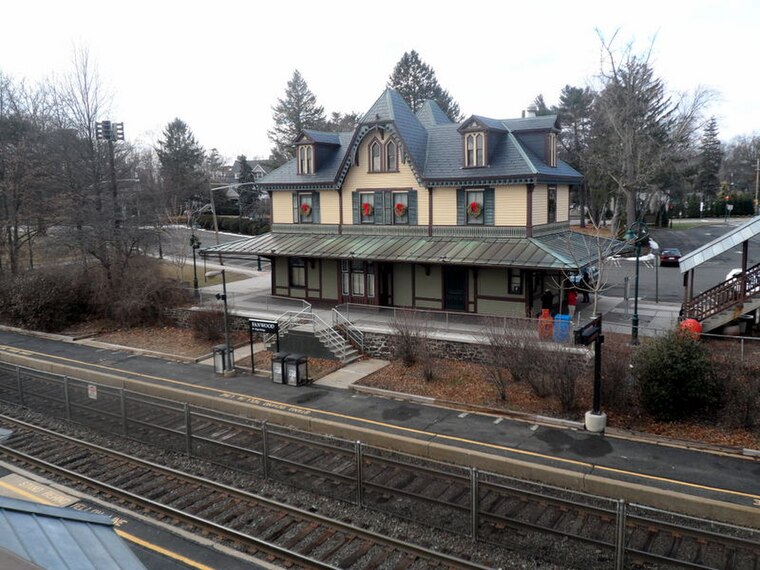
Photo: Jared Kofsky, CC BY-SA 4.0.
Scotch Plains is a town in Union County, New Jersey. This article also covers the neighboring communities of Fanwood and Plainfield. Fanwood is situated 1½ miles west of McKinley Elementary School.
Mountainside
Town

Photo: Tomwsulcer, CC0.
Mountainside is a borough in Union County, in the U.S. state of New Jersey. The borough is located on a ridge in northern-central New Jersey, within the Raritan Valley and Rahway Valley regions in the New York metropolitan area. Mountainside is situated 2 miles north of McKinley Elementary School.
McKinley Elementary School
- Type: School
- Address: 500 1st Street, Westfield, NJ 07090
- Category: education
- Location: Town of Westfield, Union County, Gateway, New Jersey, Mid-Atlantic, United States, North America
- View on OpenStreetMap
Latitude
40.64499° or 40° 38′ 42″ northLongitude
-74.3537° or 74° 21′ 13″ westOpen location code
87G7JJVW+XGOpenStreetMap ID
node 13283443450OpenStreetMap feature
amenity=school
This page is based on OpenStreetMap, Wikidata, and Wikimedia Commons.
We’d love your help improving our open data sources. Thank you for contributing.
Satellite Map
Discover McKinley Elementary School from above in high-definition satellite imagery.
Places with the Same Name
Discover other places named “McKinley Elementary School”.
Notable Places Nearby
Highlights include Saint Luke African Methodist Episcopal Zion Church and New Jersey State National Guard Armory.
Nearby Places
Explore places such as McKinley Elementary School and Holy Trinity Interparochial School.
Union County: Must-Visit Destinations
Delve into Elizabeth, Summit, Linden, and Rahway.
Curious Places to Discover
Uncover intriguing places from every corner of the globe.
About Mapcarta. Data © OpenStreetMap contributors and available under the Open Database License". Text is available under the CC BY-SA 4.0 license, except for photos, directions, and the map. Photo: Wikimedia, CC0.