Chambre d’agriculture Haute-Saône
Chambre d’agriculture Haute-Saône is a government office in Vesoul, Haute-Saône, Bourgogne-Franche-Comté. Chambre d’agriculture Haute-Saône is situated nearby to the public building Maison Départementale des Personnes Handicapées, as well as near Mutualité Sociale Agricole.| Tap on a place to explore it |
- Opening hours:
Monday—Thursday: 8:30 AM—noon and 1:30 PM—5:00 PM
Friday: 8:30 AM—noon and 1:30 PM—4:00 PM - Email: accueil@haute-saone.chambagri.fr
- Type: Government office
Places of Interest Nearby
Highlights include Vesoul station and St. George’s Church.
Vesoul station
Railway station
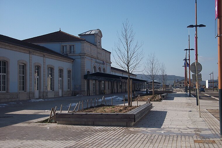
Photo: Nerio9, CC BY-SA 3.0.
Vesoul station is the railway station serving the commune of Vesoul, in the Haute-Saône department of eastern France. Vesoul station is situated 370 metres southeast of Chambre d’agriculture Haute-Saône.
St. George’s Church
Church

Photo: Remi Mathis, CC BY-SA 3.0.
The St. George's Church, Vesoul is a church in Vesoul, in France. St. George’s Church is situated 670 metres northeast of Chambre d’agriculture Haute-Saône.
Maison d’arrêt de Vesoul
Prison

Photo: Nerio9, CC BY-SA 3.0.
Maison d’arrêt de Vesoul is a prison, which is situated 700 metres northeast of Chambre d’agriculture Haute-Saône.
Places in the Area
Nearby places include Navenne and Échenoz-la-Méline.
Navenne
Village
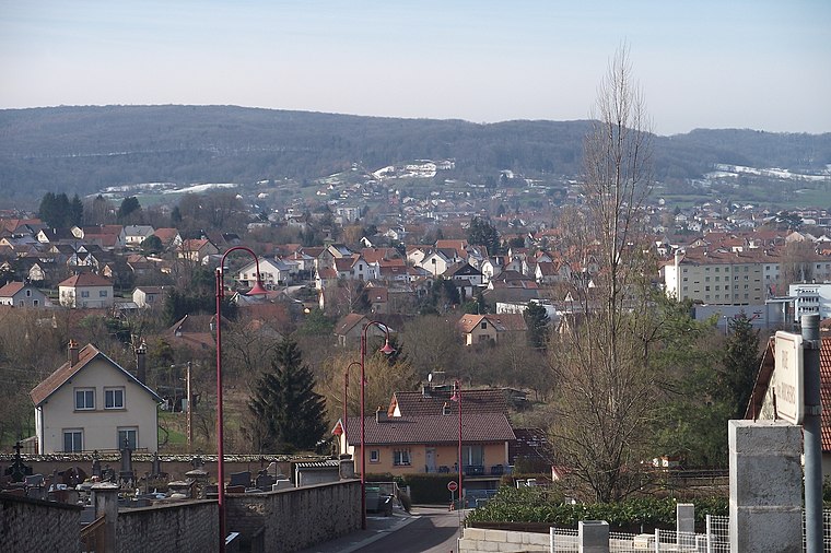
Photo: Nerio9, CC BY-SA 3.0.
Navenne is a commune in the Haute-Saône department in the region of Bourgogne-Franche-Comté in eastern France. The town is located near Vesoul.
Échenoz-la-Méline
Village

Photo: Sergevieille, CC BY-SA 4.0.
Échenoz-la-Méline is a commune in the Haute-Saône department in the region of Bourgogne-Franche-Comté in eastern France. The town is located near Vesoul.
Frotey-lès-Vesoul
Village

Photo: Nerio9, CC BY-SA 3.0.
Frotey-lès-Vesoul is a commune in the Haute-Saône department in the region of Bourgogne-Franche-Comté in eastern France. The town is located near Vesoul. Frotey-lès-Vesoul is situated 3 km east of Chambre d’agriculture Haute-Saône.
Chambre d’agriculture Haute-Saône
- Categories: office and government building
- Location: Vesoul, Arrondissement of Vesoul, Haute-Saône, Franche-Comté, Bourgogne-Franche-Comté, France, Europe
- View on OpenStreetMap
Latitude
47.62033° or 47° 37′ 13″ northLongitude
6.14891° or 6° 8′ 56″ eastOpen location code
8FV8J4CX+4HOpenStreetMap ID
node 13287690798OpenStreetMap feature
office=government
This page is based on OpenStreetMap, Wikidata, and Wikimedia Commons.
We’d love your help improving our open data sources. Thank you for contributing.
Satellite Map
Discover Chambre d’agriculture Haute-Saône from above in high-definition satellite imagery.
Notable Places Nearby
Highlights include Maison Départementale des Personnes Handicapées and Mutualité Sociale Agricole.
Nearby Places
Explore places such as Maison des agriculteurs and Jean Moulin.
Franche-Comté: Must-Visit Destinations
Delve into Besançon, Dole, Saint-Claude, and Nans-sous-Sainte-Anne.
Curious Government Offices to Discover
Uncover intriguing government offices from every corner of the globe.
About Mapcarta. Data © OpenStreetMap contributors and available under the Open Database License". Text is available under the CC BY-SA 4.0 license, except for photos, directions, and the map. Photo: Remi Mathis, CC BY-SA 3.0.