La Table des Bains
La Table des Bains is a restaurant in Lavey-Morcles, Aigle District, Vaud. La Table des Bains is situated nearby to the village Lavey-les-Bains, as well as near the police station BTB St-Maurice.| Tap on a place to explore it |
Places of Interest Nearby
Highlights include Fort de Dailly and St-Maurice railway station.
Fort de Dailly
Bunker

Photo: Sylenius, CC BY-SA 4.0.
The Fort de Dailly is the largest component of Fortress Saint-Maurice, which is in turn one of the three principal fortified regions of the National Redoubt of Switzerland. Fort de Dailly is situated 1 km northeast of La Table des Bains.
St-Maurice railway station
Railway station
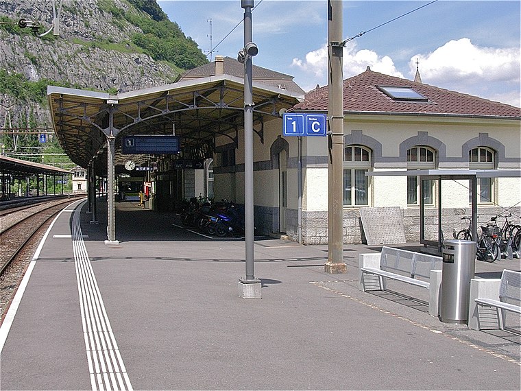
Photo: Albins, CC BY-SA 3.0.
St-Maurice railway station is a railway station in the municipality of Saint-Maurice, in the Swiss canton of Valais. It is an intermediate stop on the Simplon line and the terminus of the Saint-Gingolph–Saint-Maurice line. St-Maurice railway station is situated 2 km northwest of La Table des Bains.
Saint Sigismond church and rectory
Church

Photo: Roland Zumbühl, CC BY-SA 3.0.
Saint Sigismond church and rectory is situated 2 km northwest of La Table des Bains.
Places in the Area
Nearby places include Lavey-les-Bains and Morcles.
Lavey-les-Bains
Village
Lavey-les-Bains is a village in the district of Aigle in the canton of Vaud, Switzerland. Lavey-les-Bains is located in the former municipality Lavey. In 1852 Lavey municipality merged with its neighbor to form a new and larger municipality Lavey-Morcles.
Morcles
Village
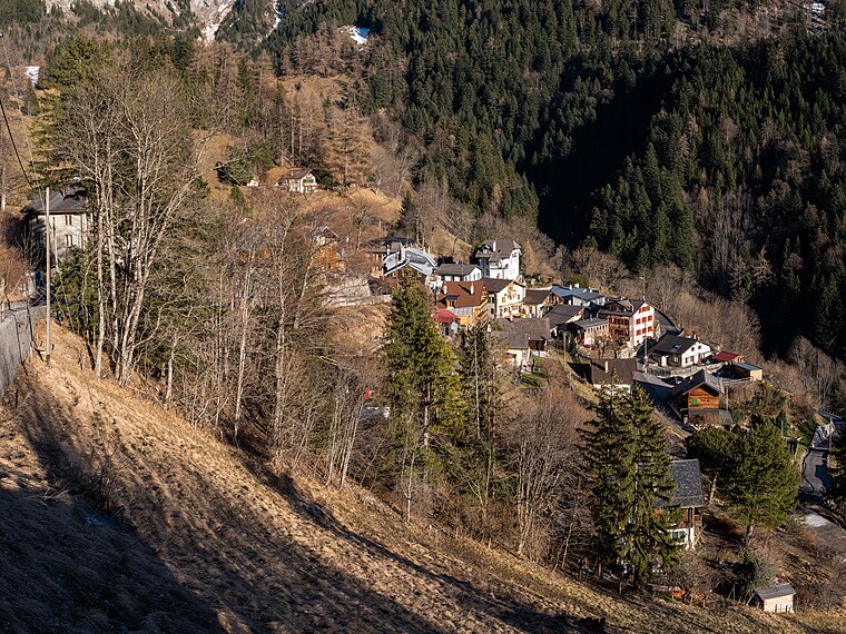
Photo: Espandero, CC BY-SA 4.0.
Morcles is a village and former municipality in the district of Aigle in the canton of Vaud, Switzerland. It was first recorded in year 1043 as Morcles.
Lavey-Village
Village
Lavey-Village is a village in the district of Aigle in the canton of Vaud, Switzerland. The village was first recorded in the year 1016 as A Laver. In 1189 it was known as Laveto.
La Table des Bains
- Type: Restaurant
- Category: food
- Location: Lavey-Morcles, Aigle District, Vaud, Western Switzerland, Switzerland, Central Europe, Europe
- View on OpenStreetMap
Latitude
46.20384° or 46° 12′ 14″ northLongitude
7.01802° or 7° 1′ 5″ eastOpen location code
8FR96239+G6OpenStreetMap ID
node 1328884791OpenStreetMap feature
amenity=restaurant
This page is based on OpenStreetMap, Wikidata, and Wikimedia Commons.
We’d love your help improving our open data sources. Thank you for contributing.
Satellite Map
Discover La Table des Bains from above in high-definition satellite imagery.
Notable Places Nearby
Highlights include BTB St-Maurice and Pilier de la Pissechèvre.
Nearby Places
Explore places such as Grand Hôtel des Bains and La Sirène.
Vaud: Must-Visit Destinations
Delve into Lausanne, Montreux, Nyon, and Vevey.
Curious Restaurants to Discover
Uncover intriguing restaurants from every corner of the globe.
About Mapcarta. Data © OpenStreetMap contributors and available under the Open Database License". Text is available under the CC BY-SA 4.0 license, except for photos, directions, and the map. Photo: Annickjaquillard, CC BY-SA 4.0.