Font de la Venus de Frejús
Font de la Venus de Frejús is a fountain in Horta-Guinardó, Barcelona, Catalonia. Font de la Venus de Frejús is situated nearby to the museum Antic Institut Ravetllat-Pla, as well as near the garden Jardins del Doctor Pla i Armengol.| Tap on a place to explore it |
Places of Interest Nearby
Highlights include Hospital de Sant Pau and Antic Institut Ravetllat-Pla.
Hospital de Sant Pau
Hospital

Photo: Matinibz, CC BY-SA 3.0.
The former Hospital de la Santa Creu i Sant Pau in the neighborhood of El Guinardó, Barcelona, Catalonia, Spain, is a complex built between 1901 and 1930. Hospital de Sant Pau is situated 370 metres east of Font de la Venus de Frejús.
Antic Institut Ravetllat-Pla
Museum

Photo: Clemens Schmillen, CC BY-SA 4.0.
Antic Institut Ravetllat-Pla is a museum.
Jardins del Doctor Pla i Armengol
Garden

Photo: Canaan, CC BY-SA 4.0.
Jardins del Doctor Pla i Armengol is a garden, which is situated 110 metres southeast of Font de la Venus de Frejús.
Places in the Area
Nearby places include El Guinardó and El Baix Guinardó.
El Guinardó
Quarter
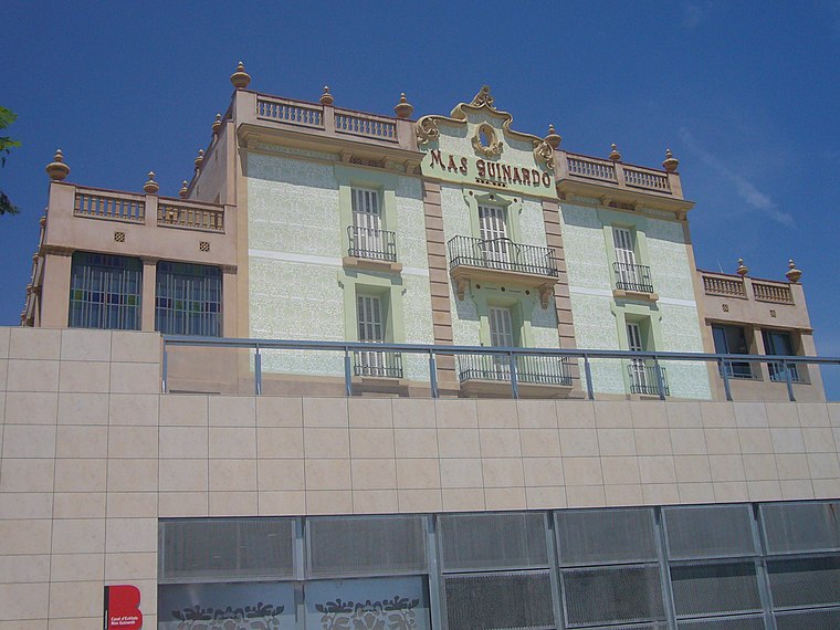
Photo: Jordiferrer, CC BY-SA 3.0.
El Guinardó is a neighborhood in the Horta-Guinardó district of Barcelona. El Guinardó is a neighborhood nestled within the old municipality of Sant Martí de Provençals, straddling the border between Horta — with which it once shared some land — and Gràcia.
El Baix Guinardó
Neighborhood
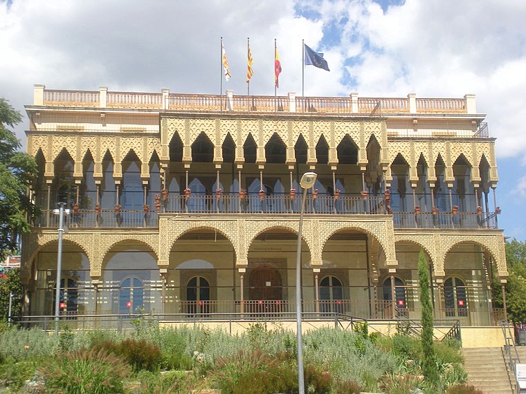
Photo: KRLS, CC BY-SA 3.0.
El Baix Guinardó is a neighborhood in the Horta-Guinardó district of Barcelona, Catalonia.
Can Baró
Neighborhood
Photo: Wikimedia, CC BY-SA 3.0.
Can Baró is a neighborhood in the Horta-Guinardó district of Barcelona, Catalonia. It is home to the Turó de la Rovira Museum of the History of Barcelona heritage site, where anti-aircraft batteries were stationed during the Spanish Civil War.
Font de la Venus de Frejús
- Type: Fountain
- Location: Horta-Guinardó, Barcelona, Barcelona, Catalonia, Eastern Spain, Spain, Iberia, Europe
- View on OpenStreetMap
Latitude
41.41618° or 41° 24′ 58″ northLongitude
2.17011° or 2° 10′ 12″ eastOpen location code
8FH4C58C+F2OpenStreetMap ID
node 13291815525OpenStreetMap feature
amenity=fountain
This page is based on OpenStreetMap, Wikidata, and Wikimedia Commons.
We’d love your help improving our open data sources. Thank you for contributing.
Satellite Map
Discover Font de la Venus de Frejús from above in high-definition satellite imagery.
Notable Places Nearby
Highlights include FC Martinenc and Centre Cívic del Guinardó.
Nearby Places
Explore places such as Fundación Ramón Pla Armengol and Espais patrimonials.
Barcelona: Must-Visit Destinations
Delve into Ciutat Vella, Eixample, Gràcia, and Sants-Montjuïc.
Curious Fountains to Discover
Uncover intriguing fountains from every corner of the globe.
About Mapcarta. Data © OpenStreetMap contributors and available under the Open Database License". Text is available under the CC BY-SA 4.0 license, except for photos, directions, and the map. Photo: phyrephox, CC BY-SA 2.0.