Coburg Flitzer
Coburg Flitzer is in Coburg, Upper Franconia, Bavaria. Coburg Flitzer is situated nearby to Evangelisch-Lutherische Kirchengemeinde St. Markus, as well as near the church Markuskirche.| Tap on a place to explore it |
Places of Interest Nearby
Highlights include Coburg and Bismarck Tower (Coburg).
Coburg
Railway station

Photo: Störfix, CC BY-SA 3.0.
Coburg is a railway station, which is situated 440 metres northeast of Coburg Flitzer.
Bismarck Tower (Coburg)
Scenic viewpoint

Photo: Presse03, CC BY-SA 3.0.
Bismarck Tower (Coburg) is a scenic viewpoint, which is situated 750 metres southwest of Coburg Flitzer.
Rathaus
Town hall
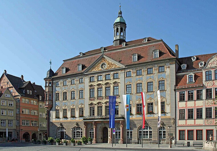
Photo: Störfix, CC BY-SA 3.0.
Rathaus is a town hall, which is situated 1 km southeast of Coburg Flitzer.
Places in the Area
Nearby places include Dörfles bei Scheuerfeld and Neuses.
Dörfles bei Scheuerfeld
Village

Photo: Wikimedia, CC BY-SA 3.0 de.
Dörfles bei Scheuerfeld is a village.


Coburg Flitzer
- Type: Carsharing
- Category: transportation
- Location: Coburg, Coburg, Upper Franconia, Franconia, Bavaria, Germany, Central Europe, Europe
- View on OpenStreetMap
Latitude
50.26117° or 50° 15′ 40″ northLongitude
10.95188° or 10° 57′ 7″ eastOpen location code
9F2G7X62+FQOpenStreetMap ID
node 13300146759OpenStreetMap feature
amenity=car_sharing
This page is based on OpenStreetMap, Wikidata, and Wikimedia Commons.
We’d love your help improving our open data sources. Thank you for contributing.
Satellite Map
Discover Coburg Flitzer from above in high-definition satellite imagery.
Places with the Same Name
Discover other places named “Coburg Flitzer”.
Notable Places Nearby
Highlights include Evangelisch-Lutherische Kirchengemeinde St. Markus and Markuskirche.
Nearby Places
Explore places such as Weimarer Straße and Weimarer Straße.
Upper Franconia: Must-Visit Destinations
Delve into Bamberg, Bayreuth, Hof, and Kulmbach.
Curious Places to Discover
Uncover intriguing places from every corner of the globe.
About Mapcarta. Data © OpenStreetMap contributors and available under the Open Database License". Text is available under the CC BY-SA 4.0 license, except for photos, directions, and the map. Photo: Benreis, CC BY 3.0.