(M)Body
(M)Body is a work of art in City of Columbus, Franklin, Ohio. (M)Body is situated nearby to the sports venue Recreation & Physical Activity Center, as well as near Ohio Stadium.| Tap on a place to explore it |
Places of Interest Nearby
Highlights include Ohio Stadium and William Oxley Thompson Memorial Library.
Ohio Stadium
Stadium

Photo: Lectrician2, CC BY-SA 4.0.
Ohio Stadium is an American football stadium in Columbus, Ohio, on the campus of Ohio State University. It primarily serves as the home venue of the Ohio State Buckeyes football team and is also the site for the university's Spring Commencement ceremonies each May. Ohio Stadium is situated 760 feet northwest of (M)Body.
William Oxley Thompson Memorial Library
Library

Photo: Michael Barera, CC BY-SA 4.0.
The William Oxley Thompson Memorial Library is the main library at Ohio State University's Columbus campus. It is the university's largest library and houses its main stacks, special collections, rare books and manuscripts, and many departmental subject libraries. William Oxley Thompson Memorial Library is situated 860 feet southeast of (M)Body.
Wexner Center for the Arts
Arts center
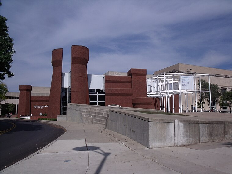
Photo: Ibagli, Public domain.
The Wexner Center for the Arts is the Ohio State University's "multidisciplinary, international laboratory for the exploration and advancement of contemporary art." The Wexner Center is a lab and public gallery, but not an art museum, as it does not collect art. Wexner Center for the Arts is situated 2,300 feet east of (M)Body.
Places in the Area
Nearby places include University Area and Northwood Park.
University Area
 University Area also known as the University District is the area around the Ohio State University in Columbus, Ohio. It also includes the OSU Hospital and The James Cancer Research Hospital.
Northwood Park
Neighborhood
The Oakland & Northwood Avenue Area is located in the northern University District in Columbus, Ohio and is bounded by Patterson Avenue to the north and Northwood Avenue to the south & Pearl Alley to the west and Indianola Avenue to the east.
Old North Columbus
Neighborhood

Photo: JBTHEMILKER, CC BY-SA 4.0.
Old North Columbus is a neighborhood located just north of the Ohio State University in Columbus, Ohio. It was founded in 1847 as a stand-alone city outside the City of Columbus, then incorporated into Columbus in 1871.
(M)Body
- Type: Work of art
- Artwork type: sculpture
- Category: tourism
- Location: City of Columbus, Franklin, Ohio, Midwest, United States, North America
- View on OpenStreetMap
Latitude
40.00035° or 40° 0′ 1″ northLongitude
-83.01761° or 83° 1′ 3″ westOpen location code
86GR2X2J+4XOpenStreetMap ID
node 13300872850OpenStreetMap feature
tourism=artworkOpenStreetMap attribute
artwork_type=sculpture
This page is based on OpenStreetMap, Wikidata, and Wikimedia Commons.
We’d love your help improving our open data sources. Thank you for contributing.
Satellite Map
Discover (M)Body from above in high-definition satellite imagery.
Notable Places Nearby
Highlights include Recreation & Physical Activity Center and Safelite Field.
Nearby Places
Explore places such as RPAC Plaza and Celebration Drum Circle.
Ohio: Must-Visit Destinations
Delve into Columbus, Cincinnati, Cleveland, and Bowling Green.
Curious Work Of Arts to Discover
Uncover intriguing work of arts from every corner of the globe.
About Mapcarta. Data © OpenStreetMap contributors and available under the Open Database License". Text is available under the CC BY-SA 4.0 license, except for photos, directions, and the map. Photo: Wikimedia, CC0.