Melnik Health
Melnik Health is in Lower Saxony, Germany, and is located on Hohenzollernstraße. Melnik Health is situated nearby to the work of art Ibex, as well as near the pond Großer Teich (Eilenriede).| Tap on a place to explore it |
Places of Interest Nearby
Highlights include Hochschule für Musik, Theater und Medien Hannover and Großer Teich (Eilenriede).
Hochschule für Musik, Theater und Medien Hannover
University
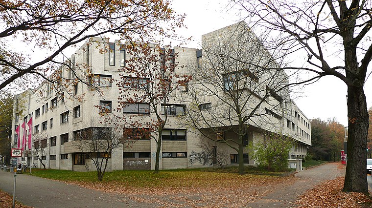 Hanover University of Music, Drama and Media is a university of performing arts and media in Hanover, the capital of Lower Saxony, Germany. Dating to 1897, it has reorganised and changed names as it developed over the years, most recently in 2010 when it changed from State College of Music and Drama Hanover. Hochschule für Musik, Theater und Medien Hannover is situated 240 metres south of Melnik Health.
Großer Teich (Eilenriede)
Pond

Photo: Bernd Schwabe in Hannover, CC BY-SA 3.0.
Großer Teich (Eilenriede) is a pond, which is situated 140 metres east of Melnik Health.
Dreifaltigkeitskirche (Hannover)
Church

Photo: AxelHH, Public domain.
Dreifaltigkeitskirche (Hannover) is a church, which is situated 260 metres northwest of Melnik Health.
Places in the Area
Nearby places include Oststadt and Hanover.

Hanover

Photo: Pedelecs, CC BY-SA 3.0.
Hanover is the capital of Lower Saxony in Germany. Hanover built a huge exhibition complex for the World Expo in 2000 and has been host to several of the biggest exhibitions in the world.
Kreuzkirchenviertel
Neighborhood

Photo: Bernd Schwabe in Hannover, CC BY-SA 3.0.
Kreuzkirchenviertel is a neighborhood.
Melnik Health
- Type: Health care
- Address: Hohenzollernstraße 11
- Location: Lower Saxony, Germany, Central Europe, Europe
- View on OpenStreetMap
Latitude
52.37979° or 52° 22′ 47″ northLongitude
9.75457° or 9° 45′ 17″ eastOpen location code
9F4F9QH3+WROpenStreetMap ID
node 13302110611OpenStreetMap feature
healthcare=alternative
This page is based on OpenStreetMap, Wikidata, and Wikimedia Commons.
We’d love your help improving our open data sources. Thank you for contributing.
Satellite Map
Discover Melnik Health from above in high-definition satellite imagery.
Notable Places Nearby
Highlights include Ibex and Stolperstein dedicated to Henriette Gottschalk.
Nearby Places
Explore places such as leine weber and alphaBIT.
Lower Saxony: Must-Visit Destinations
Delve into Hanover, Göttingen, Brunswick, and Wolfsburg.
Curious Places to Discover
Uncover intriguing places from every corner of the globe.
About Mapcarta. Data © OpenStreetMap contributors and available under the Open Database License". Text is available under the CC BY-SA 4.0 license, except for photos, directions, and the map. Photo: Danapit, CC BY-SA 3.0.