Instituto de Previsión Social
Instituto de Previsión Social is a government office in Arica, Arica y Parinacota Region which is located on Doctor Juan Noé. Instituto de Previsión Social is situated nearby to the government office Policia de Investigaciones, as well as near the park Plaza Arauco.| Tap on a place to explore it |
Places of Interest Nearby
Highlights include Estadio Carlos Dittborn and Casa Yanulaque.
Estadio Carlos Dittborn
Stadium

Photo: Wikimedia, CC BY 3.0 cl.
The Carlos Dittborn Stadium is a multi-purpose stadium in Arica, Chile. Primarily used for football matches, it was constructed in 1962 specifically for the purpose of hosting games during the 1962 World Cup, which took place in Chile. Estadio Carlos Dittborn is situated 1½ km southeast of Instituto de Previsión Social.
Casa Yanulaque
Monument
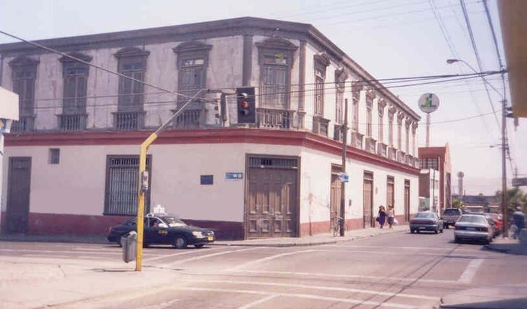
Photo: Wikimedia, CC BY-SA 2.5.
The Casa Yanulaque is a historical building located in the Chilean city of Arica, in the corner of 18 de Septiembre and General Lagos streets. It is owned by the Peruvian State as part of the 1929 Treaty of Lima, and currently houses its consulate-general. Casa Yanulaque is situated 560 metres west of Instituto de Previsión Social.
Casa Bolognesi
Government office

Photo: Wikimedia, CC BY-SA 2.0.
The Casa Bolognesi, also known as the Casa de la Respuesta, is a historical building owned by the Peruvian State located in Arica, Chile. It is the site of a meeting that preceded the Battle of Arica during the War of the Pacific. Casa Bolognesi is situated 1 km west of Instituto de Previsión Social.
Places in the Area
Nearby places include Villa Frontera.
Villa Frontera
Village
Villa Frontera, also identified as Chacalluta, is a village within the Arica Province of the Arica and Parinacota Region, Chile. Villa Frontera is situated 9 km north of Instituto de Previsión Social.
Instituto de Previsión Social
- Type: Government office
- Address: 933 Doctor Juan Noé, Arica
- Categories: office and government building
- Location: Arica, Arica Province, Arica y Parinacota Region, Northern Chile, Chile, South America
- View on OpenStreetMap
Latitude
-18.47899° or 18° 28′ 44″ southLongitude
-70.3108° or 70° 18′ 39″ westOpen location code
57HFGMCQ+CMOpenStreetMap ID
node 13305279881OpenStreetMap feature
office=government
This page is based on OpenStreetMap, Wikidata, and Wikimedia Commons.
We’d love your help improving our open data sources. Thank you for contributing.
Satellite Map
Discover Instituto de Previsión Social from above in high-definition satellite imagery.
Places with the Same Name
Discover other places named “Instituto de Previsión Social”.
Notable Places Nearby
Highlights include Policia de Investigaciones and Plaza Arauco.
Nearby Places
Explore places such as Estacionamientos Carnicerías Arauco and Jardín Infantil Bethel de Arica.
Northern Chile: Must-Visit Destinations
Delve into Antofagasta, La Serena, Iquique, and San Pedro de Atacama.
Curious Government Offices to Discover
Uncover intriguing government offices from every corner of the globe.
About Mapcarta. Data © OpenStreetMap contributors and available under the Open Database License". Text is available under the CC BY-SA 4.0 license, except for photos, directions, and the map. Photo: Till.niermann, CC BY-SA 3.0.