Wie hoch ist der Baum
Wie hoch ist der Baum is in Hechingen, Zollernalbkreis, Baden-Württemberg. Wie hoch ist der Baum is situated nearby to Pirschweg, as well as near Wurzelwerk.| Tap on a place to explore it |
Places of Interest Nearby
Highlights include Martinsberg and Villa Eugenia.

Villa Eugenia
Castle
 Villa Eugenia is a castle, which is situated 1½ km southeast of Wie hoch ist der Baum.
New Castle
Castle
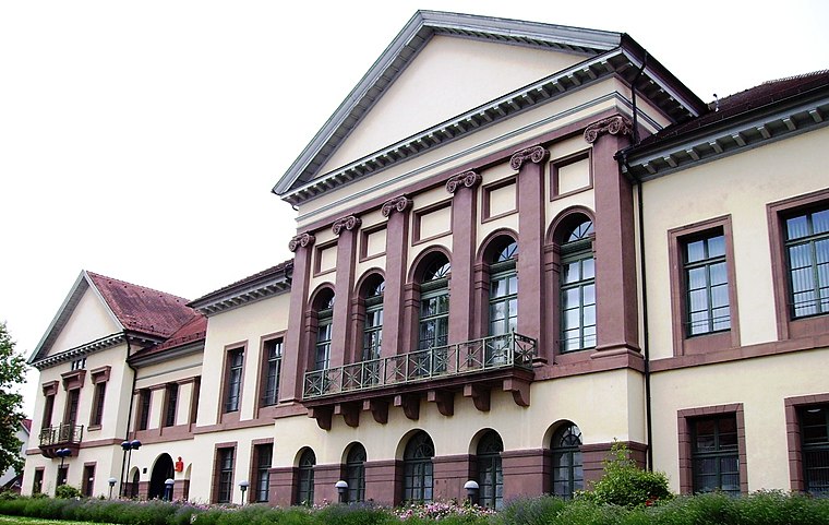
Photo: Muesse, CC BY-SA 3.0.
The New Castle is a nineteenth century palace in Hechingen in Germany. It served as the city residence for princes of the House of Hohenzollern-Hechingen. New Castle is situated 1½ km east of Wie hoch ist der Baum.
Places in the Area
Nearby places include Zimmern and Grosselfingen.
Zimmern
Village

Photo: Zollernalb, CC BY 2.5.
Zimmern is a village, which is situated 4 km south of Wie hoch ist der Baum.
Grosselfingen
Village

Photo: Zollernalb, CC BY-SA 4.0.
Grosselfingen is a town in the Zollernalbkreis district, in Baden-Württemberg, Germany. Grosselfingen is situated 4½ km southwest of Wie hoch ist der Baum.
Rangendingen
Village
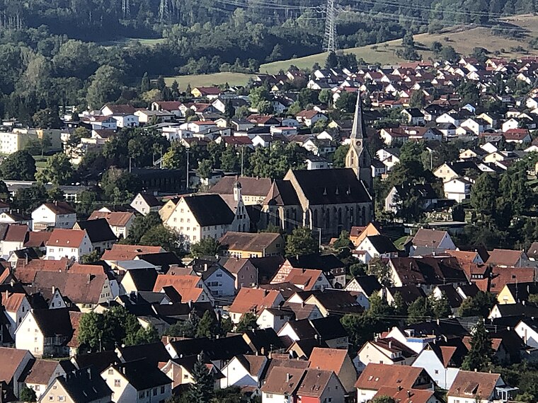
Photo: Zollernalb, CC BY-SA 4.0.
Rangendingen is a municipality of the Zollernalbkreis district, in Baden-Württemberg, Germany. Rangendingen is situated 4½ km northwest of Wie hoch ist der Baum.
Wie hoch ist der Baum
- Type: Tourist attraction
- Category: tourism
- Location: Hechingen, Zollernalbkreis, Tübingen Region, Baden-Württemberg, Germany, Central Europe, Europe
- View on OpenStreetMap
Latitude
48.35506° or 48° 21′ 18″ northLongitude
8.94038° or 8° 56′ 25″ eastOpen location code
8FWC9W4R+25OpenStreetMap ID
node 13308365532OpenStreetMap feature
tourism=attraction
This page is based on OpenStreetMap, Wikidata, and Wikimedia Commons.
We’d love your help improving our open data sources. Thank you for contributing.
Satellite Map
Discover Wie hoch ist der Baum from above in high-definition satellite imagery.
Places with the Same Name
Discover other places named “Wie hoch ist der Baum”.
Notable Places Nearby
Highlights include Pirschweg and Wurzelwerk.
Nearby Places
Explore places such as Rehe and Wandern in Hechingen.
Baden-Württemberg: Must-Visit Destinations
Delve into Stuttgart, Heidelberg, Karlsruhe, and Mannheim.
Curious Places to Discover
Uncover intriguing places from every corner of the globe.
About Mapcarta. Data © OpenStreetMap contributors and available under the Open Database License". Text is available under the CC BY-SA 4.0 license, except for photos, directions, and the map. Photo: Traveler100, CC BY-SA 3.0.