Onkel Ali
Onkel Ali is a fast food restaurant in Rheine, Steinfurt, North Rhine-Westphalia which is located on Matthiasstraße. Onkel Ali is situated nearby to the library Stadtbücherei, as well as near the tourism office Touristinformation.| Tap on a place to explore it |
- Type: Fast food restaurant
- Cuisine: pizza and kebab
- Address: Matthiasstraße 6, Rheine, 48431
Places of Interest Nearby
Highlights include Rheine station and St. Dionysius (Rheine).
Rheine station
Railway station
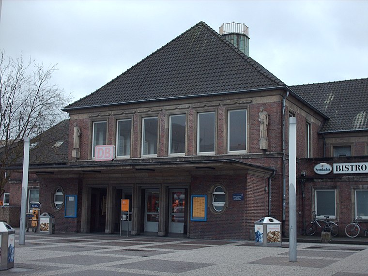
Photo: Stefan Flöper, CC BY-SA 4.0.
Rheine is a railway station located in Rheine, Germany. The station is located on the Löhne–Rheine, Emsland Railway and the Münster–Rheine lines. The train services are operated by Deutsche Bahn, WestfalenBahn and National Express. Rheine station is situated 200 metres southwest of Onkel Ali.
St. Dionysius (Rheine)
Church

Photo: Drooker, CC BY-SA 3.0.
St. Dionysius (Rheine) is a church, which is situated 290 metres northeast of Onkel Ali.
Nepomukstatue
Work of art

Photo: Tubantia, CC BY-SA 3.0.
Nepomukstatue is a work of art, which is situated 410 metres northeast of Onkel Ali.
Places in the Area
Nearby places include Südesch and Wadelheim.

Wadelheim
Suburb

Photo: Zumthie, Public domain.
Wadelheim is a suburb, which is situated 2½ km west of Onkel Ali.
Neuenkirchen
Village

Photo: Michielverbeek, CC BY-SA 3.0.
Neuenkirchen is a municipality in the district of Steinfurt, in North Rhine-Westphalia, Germany. Neuenkirchen is the biggest village in the district of Steinfurt and noted for its stately homes. Neuenkirchen is situated 6 km southwest of Onkel Ali.
Onkel Ali
- Categories: food and restaurant
- Location: Rheine, Steinfurt, Münster, Münsterland, North Rhine-Westphalia, Germany, Central Europe, Europe
- View on OpenStreetMap
Latitude
52.27706° or 52° 16′ 37″ northLongitude
7.4365° or 7° 26′ 11″ eastOpen location code
9F497CGP+RHOpenStreetMap ID
node 1331538416OpenStreetMap feature
amenity=fast_foodOpenStreetMap attribute
cuisine=pizzaOpenStreetMap attribute
cuisine=kebab
This page is based on OpenStreetMap, Wikidata, and Wikimedia Commons.
We’d love your help improving our open data sources. Thank you for contributing.
Satellite Map
Discover Onkel Ali from above in high-definition satellite imagery.
Places with the Same Name
Discover other places named “Onkel Ali”.
Notable Places Nearby
Highlights include Touristinformation and Stadtbücherei.
Nearby Places
Explore places such as Einstein and Bustreff.
Münsterland: Must-Visit Destinations
Delve into Münster, Bocholt, Dülmen, and Haltern am See.
Curious Fast Food Restaurants to Discover
Uncover intriguing fast food restaurants from every corner of the globe.
About Mapcarta. Data © OpenStreetMap contributors and available under the Open Database License". Text is available under the CC BY-SA 4.0 license, except for photos, directions, and the map. Photo: XRay, CC BY-SA 4.0.