tinglao
tinglao is a café in Pájara, Las Palmas. tinglao is situated nearby to the hotel building MUR Faro Jandia Fuerteventura & Spa, as well as near the amusement arcade Imperial.| Tap on a place to explore it |
- Opening hours:
Monday—Friday: 9:30 AM—2:00 PM and 5:00 PM—8:00 PM
Saturday—Sunday: 9:30 AM—2:00 PM and 4:30 PM—8:00 PM - Type: Café
- Cuisine: cake, coffee shop, and sandwich
Places of Interest Nearby
Highlights include Morro Jable Lighthouse and IFA Altamarena Hotel.
Morro Jable Lighthouse
Lighthouse
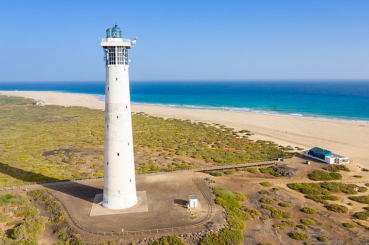 The Morro Jable Lighthouse is an active lighthouse on the Canary island of Fuerteventura. The lighthouse is situated at the edge of the beach near the town and resort of Morro Jable. Morro Jable Lighthouse is situated 390 metres south of tinglao.
IFA Altamarena Hotel
Hotel

Photo: Addshore, CC BY-SA 4.0.
IFA Altamarena Hotel is situated 790 metres west of tinglao.
Hotel Riu Palace Jandia
Hotel

Photo: Josi, CC BY-SA 4.0.
Hotel Riu Palace Jandia is situated 1¼ km west of tinglao.
Places in the Area
Nearby places include Morro Jable.
Morro Jable
Suburb
 Morro Jable is a locality belonging of the municipality of Pájara, in the island of Fuerteventura, Canary Islands, Spain. With around 7,000 inhabitants as of 2020, it is the most populated settlement in the municipality.
tinglao
- Location: Pájara, Las Palmas, Canary Islands, Spain, Iberia, Europe
- View on OpenStreetMap
Latitude
28.04963° or 28° 2′ 59″ northLongitude
-14.33285° or 14° 19′ 58″ westOpen location code
7CW72MX8+RVOpenStreetMap ID
node 13319709601OpenStreetMap feature
amenity=cafeOpenStreetMap attribute
cuisine=cakeOpenStreetMap attribute
cuisine=coffee_shopOpenStreetMap attribute
cuisine=sandwich
This page is based on OpenStreetMap, Wikidata, and Wikimedia Commons.
We’d love your help improving our open data sources. Thank you for contributing.
Satellite Map
Discover tinglao from above in high-definition satellite imagery.
Places with the Same Name
Discover other places named “tinglao”.
Notable Places Nearby
Highlights include MUR Faro Jandia Fuerteventura & Spa and Imperial.
Nearby Places
Explore places such as Paula’s and Koume y Hermana.
Canary Islands: Must-Visit Destinations
Delve into Santa Cruz de Tenerife, Las Palmas, La Palma, and La Gomera.
Curious Cafés to Discover
Uncover intriguing cafés from every corner of the globe.
About Mapcarta. Data © OpenStreetMap contributors and available under the Open Database License". Text is available under the CC BY-SA 4.0 license, except for photos, directions, and the map. Photo: Wikimedia, CC BY-SA 4.0.