Monumento al Cacique Aymaco
Monumento al Cacique Aymaco is a monument in Aguadilla Barrio-Pueblo, Aguadilla. Monumento al Cacique Aymaco is situated nearby to the government office Centro Judicial, as well as near Coliseo Luis T Diaz.| Tap on a place to explore it |
Places of Interest Nearby
Highlights include Aguadilla City Hall and Iglesia de San Carlos Borromeo.
Aguadilla City Hall
Town hall

Photo: Ipoellet, CC BY-SA 4.0.
Aguadilla City Hall is a town hall, which is situated 510 metres north of Monumento al Cacique Aymaco.
Iglesia de San Carlos Borromeo
Church

Photo: Wikimedia, Public domain.
Iglesia de San Carlos Borromeo is a historic church built in 1783, located on the main plaza of Aguadilla, Puerto Rico. It was listed on the U.S. National Register of Historic Places in 1984, and on the Puerto Rico Register of Historic Sites and Zones in 2000. Iglesia de San Carlos Borromeo is situated 550 metres north of Monumento al Cacique Aymaco.
Aguadilla Ice Skating Arena
Ice rink
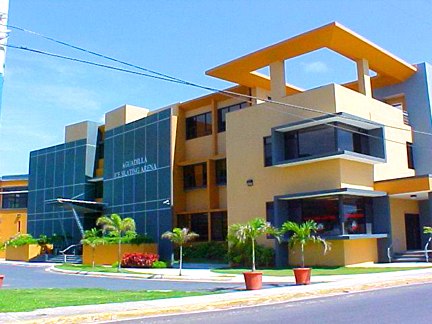
Photo: Erniefr, CC BY-SA 3.0.
Aguadilla Ice Skating Arena, A.I.S.A, is a multi-use facility in Aguadilla, Puerto Rico. The arena was the only ice skating facility in the Caribbean region. Aguadilla Ice Skating Arena is situated 730 metres south of Monumento al Cacique Aymaco.
Places in the Area
Nearby places include Moca and Aguada.
Moca

Photo: Mercy11, CC BY-SA 4.0.
Moca is a town and municipality in Porta del Sol region of Puerto Rico. It is located southeast of Aguadilla.
Aguada

Photo: Wikimedia, CC BY-SA 2.0.
Aguada is a town and municipality located in northwestern Puerto Rico, in the Porta del Sol tourism region. The town is one of the oldest settlements in the island and has popular beaches and a historic sugarcane refinery.
Monumento al Cacique Aymaco
- Type: Monument
- Category: historic site
- Location: Aguadilla Barrio-Pueblo, Aguadilla, Porta del Sol, Puerto Rico, Caribbean, North America
- View on OpenStreetMap
Latitude
18.42497° or 18° 25′ 30″ northLongitude
-67.15506° or 67° 9′ 18″ westOpen location code
77CJCRFV+XXOpenStreetMap ID
node 13322038378OpenStreetMap feature
historic=monument
This page is based on OpenStreetMap, Wikidata, and Wikimedia Commons.
We’d love your help improving our open data sources. Thank you for contributing.
Satellite Map
Discover Monumento al Cacique Aymaco from above in high-definition satellite imagery.
Notable Places Nearby
Highlights include Centro Judicial and Coliseo Luis T Diaz.
Nearby Places
Explore places such as Cafeteria El Judicial and Los Pollos.
Porta del Sol: Must-Visit Destinations
Delve into Mayagüez, Rincón, Aguada, and Cabo Rojo.
Curious Monuments to Discover
Uncover intriguing monuments from every corner of the globe.
About Mapcarta. Data © OpenStreetMap contributors and available under the Open Database License". Text is available under the CC BY-SA 4.0 license, except for photos, directions, and the map. Photo: Tom Vazquez, Public domain.