URBAN JUNGLE 2.0
URBAN JUNGLE 2.0 is a work of art in Landstraße, Vienna. URBAN JUNGLE 2.0 is situated nearby to the government office Finanzzentrum Wien Mitte, as well as near the metro station Landstraße station.| Tap on a place to explore it |
Places of Interest Nearby
Highlights include University of Applied Arts Vienna and Museum of Applied Arts, Vienna.
University of Applied Arts Vienna
University

Photo: Maclemo, CC BY-SA 3.0.
The University of Applied Arts Vienna is an arts university and institution of higher education in Vienna, the capital of Austria. It has had university status since 1970. University of Applied Arts Vienna is situated 180 metres northwest of URBAN JUNGLE 2.0.
Museum of Applied Arts, Vienna
Museum
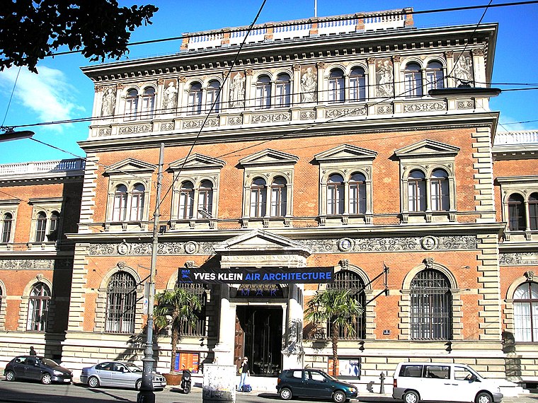
Photo: Gryffindor, CC BY 2.5.
The MAK – Museum of Applied Arts is an arts and crafts museum located at Stubenring 5 in Vienna's 1st district Innere Stadt. Besides its traditional orientation towards arts and crafts and design, the museum especially focuses on architecture and contemporary art. Museum of Applied Arts, Vienna is situated 220 metres west of URBAN JUNGLE 2.0.
Wien
River

Photo: Invisigoth67, CC BY-SA 3.0.
The Wien is a river that flows through the capital of Austria, Vienna.
Places in the Area
Nearby places include Bermudadreieck and Pratercottage.


Innere Stadt

Photo: Thoodor, CC BY-SA 3.0 at.
Innere Stadt is the inner-most district of Vienna. Its historic centre dates back to Roman ages and has been inscribed on the UNESCO World Heritage list.
URBAN JUNGLE 2.0
- Type: Work of art
- Artwork type: mural
- Category: tourism
- Location: Landstraße, Vienna, Austria, Central Europe, Europe
- View on OpenStreetMap
Latitude
48.20735° or 48° 12′ 26″ northLongitude
16.38474° or 16° 23′ 5″ eastInception
2018Open location code
8FWR694M+WVOpenStreetMap ID
node 13328485953OpenStreetMap feature
tourism=artworkOpenStreetMap attribute
artwork_type=mural
This page is based on OpenStreetMap, Wikidata, and Wikimedia Commons.
We’d love your help improving our open data sources. Thank you for contributing.
Satellite Map
Discover URBAN JUNGLE 2.0 from above in high-definition satellite imagery.
Notable Places Nearby
Highlights include Finanzzentrum Wien Mitte and Landstraße station.
Nearby Places
Explore places such as Der Mann and Interspar.
Vienna: Must-Visit Destinations
Delve into Innere Stadt, Vienna International Airport, Inner East, and Alsergrund.
Curious Work Of Arts to Discover
Uncover intriguing work of arts from every corner of the globe.
About Mapcarta. Data © OpenStreetMap contributors and available under the Open Database License". Text is available under the CC BY-SA 4.0 license, except for photos, directions, and the map. Photo: Miguel Mendez, CC BY 2.0.