Almlehrpfad
Almlehrpfad is in Seckau, Murtal District, Styria. Almlehrpfad is situated nearby to the church Kalvarienbergkirche am Tremmelberg, as well as near the scenic viewpoint Tower Power.| Tap on a place to explore it |
Places of Interest Nearby
Highlights include Kalvarienbergkirche am Tremmelberg and Tower Power.
Kalvarienbergkirche am Tremmelberg
Church

Photo: Dnalor 01, CC BY-SA 3.0 at.
Kalvarienbergkirche am Tremmelberg is a church.
Tower Power
Scenic viewpoint
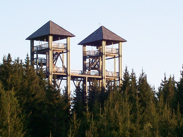
Photo: Wikimedia, Public domain.
Tower Power is a scenic viewpoint, which is situated 520 metres south of Almlehrpfad.
Places in the Area
Nearby places include Spielberg and Flatschach.
Spielberg

Photo: TheRunnerUp, CC BY-SA 4.0.
Spielberg is a municipality in the Murtal district in the Austrian state of Styria. In spite of being a small city of only around 5,400 inhabitants, it contributes significantly to the tourist industry of Styria, as the community is home of the Red Bull Ring race track.
Flatschach
Village
Flatschach is a former municipality in the district of Murtal in Styria, Austria. Since the 2015 Styria municipal structural reform, it became a part of the municipality Spielberg. Flatschach is situated 4½ km southwest of Almlehrpfad.
Knittelfeld

Photo: Guschi, CC BY-SA 3.0.
Knittelfeld is a city in Styria, Austria, located on the banks of the Mur river. The name of the town has become notorious for the Knittelfeld Putsch of September 7, 2002, a party meeting of the Freedom Party of Austria, which resulted in the 2002 Austrian elections.
Almlehrpfad
- Type: Sign
- Categories: information and tourism
- Location: Seckau, Murtal District, Styria, Austria, Central Europe, Europe
- View on OpenStreetMap
Latitude
47.25087° or 47° 15′ 3″ northLongitude
14.78663° or 14° 47′ 12″ eastOpen location code
8FVP7Q2P+8MOpenStreetMap ID
node 13365269409OpenStreetMap feature
tourism=information
This page is based on OpenStreetMap, Wikidata, and Wikimedia Commons.
We’d love your help improving our open data sources. Thank you for contributing.
Satellite Map
Discover Almlehrpfad from above in high-definition satellite imagery.
Notable Places Nearby
Highlights include WALD MUSEUM and Ingeringbach.
Nearby Places
Explore places such as Almlehrpfad and Rokop.
Styria: Must-Visit Destinations
Delve into Graz, Leoben, Bruck an der Mur, and Kapfenberg.
Curious Places to Discover
Uncover intriguing places from every corner of the globe.
About Mapcarta. Data © OpenStreetMap contributors and available under the Open Database License". Text is available under the CC BY-SA 4.0 license, except for photos, directions, and the map. Photo: Kmarka, CC BY-SA 3.0.