Vitaparcour Bürchen
Vitaparcour Bürchen is an outdoor gym in Bürchen, Raron District, Valais. Vitaparcour Bürchen is situated nearby to the square Holzlagerplatz, as well as near the motorhome stopover Stellplatz Camp Bietschhorn.| Tap on a place to explore it |
Places of Interest Nearby
Highlights include Bonigersee and Raron airfield.
Bonigersee
Lake
Bonigersee is a lake at Törbel in the canton of Valais, Switzerland. Its surface area is 0.9 ha. The raised bog is listed in the Federal Inventory of Raised and Transitional Bogs of National Importance and the Federal Inventory of Amphibian Spawning Areas.
Raron airfield
Aerodrome

Photo: Carsten Steger, CC BY-SA 4.0.
Raron airfield is an aerodrome, which is situated 3½ km north of Vitaparcour Bürchen.
Medieval castle ruins stone house and the ruins of a Zwingherren castle
Castle
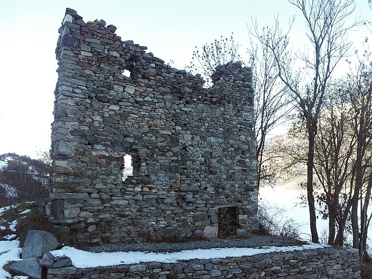
Photo: Amagra lacroix, CC BY-SA 3.0.
Medieval castle ruins stone house and the ruins of a Zwingherren castle is situated 3½ km northwest of Vitaparcour Bürchen.
Places in the Area
Nearby places include Moosalp and Visp.
Moosalp
Locality

Photo: Daniel Reust, CC BY-SA 4.0.
The Moosalp is a high mountain pass across the western Pennine Alps, connecting Bürchen with Törbel in the canton of Valais in Switzerland. The pass lies north-east of Augstbordhorn. Moosalp is situated 3 km south of Vitaparcour Bürchen.
Visp

Photo: Fabienp, CC BY-SA 3.0.
Visp is a German-speaking town in the Swiss canton of Valais. It is located in the Rhone valley and is a major industrial centre in the region. Its location at the intersection of three train lines and a big bus interchange make it a gateway to many of the towns and resorts in the upper part of the Valais.
Baltschieder
Village
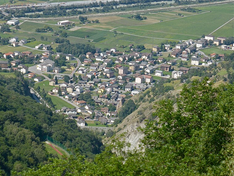
Photo: Albins, CC BY-SA 4.0.
Baltschieder is a municipality in the district of Visp in the canton of Valais in Switzerland. Baltschieder is situated 4 km northeast of Vitaparcour Bürchen.
Vitaparcour Bürchen
- Type: Outdoor gym
- Categories: gym, recreation area, and sports location
- Location: Bürchen, Raron District, Valais, Switzerland, Central Europe, Europe
- View on OpenStreetMap
Latitude
46.27628° or 46° 16′ 35″ northLongitude
7.83538° or 7° 50′ 7″ eastOpen location code
8FR97RGP+G5OpenStreetMap ID
node 13374100628OpenStreetMap feature
leisure=fitness_stationOpenStreetMap feature
sport=fitness
This page is based on OpenStreetMap, Wikidata, and Wikimedia Commons.
We’d love your help improving our open data sources. Thank you for contributing.
Satellite Map
Discover Vitaparcour Bürchen from above in high-definition satellite imagery.
Notable Places Nearby
Highlights include Vitaparcour Bürchen Stop and Holzlagerplatz.
Nearby Places
Explore places such as Bürchen, Bethania and Bürchen, Egga.
Valais: Must-Visit Destinations
Delve into Sion, Zermatt, Martigny, and Brig.
Curious Outdoor Gyms to Discover
Uncover intriguing outdoor gyms from every corner of the globe.
About Mapcarta. Data © OpenStreetMap contributors and available under the Open Database License". Text is available under the CC BY-SA 4.0 license, except for photos, directions, and the map. Photo: Debugman, CC BY 3.0.