Perreau
Perreau is a hamlet in Saint-Michel-de-Montaigne, Arrondissement of Bergerac, Nouvelle-Aquitaine. Perreau is situated nearby to the locality Bouty, as well as near the hamlet La Font du Rat.| Tap on a place to explore it |
Places of Interest
Highlights include Château de Montaigne and Église Saint-Michel de Saint-Michel-de-Montaigne.
Château de Montaigne
Castle

Photo: Henrysalome, CC BY-SA 4.0.
The Château de Montaigne is a castle mansion situated on the borders of Périgord and Bordelais, near Bergerac and Saint-Émilion, in the small commune of Saint-Michel-de-Montaigne in the Dordogne département of France.
Église Saint-Michel de Saint-Michel-de-Montaigne
Church

Photo: Henrysalome, CC BY-SA 4.0.
Église Saint-Michel de Saint-Michel-de-Montaigne is a church.

Places in the Area
Nearby places include Lamothe-Montravel and Saint-Vivien.
Lamothe-Montravel
Village

Photo: Pays du Grand Bergeracois, CC BY-SA 3.0.
Lamothe-Montravel is a commune in the Dordogne department in Nouvelle-Aquitaine in southwestern France. Lamothe-Montravel station has rail connections to Bordeaux, Bergerac and Sarlat-la-Canéda. Lamothe-Montravel is situated 3 km southwest of Perreau.
Saint-Vivien
Village

Photo: Pays du Grand Bergeracois, CC BY-SA 3.0.
Saint-Vivien is a commune in the Dordogne department in Nouvelle-Aquitaine in southwestern France. Saint-Vivien is situated 5 km northeast of Perreau.
Vélines
Village
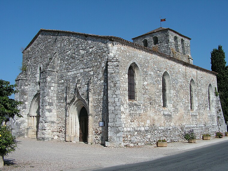
Photo: Pays du Grand Bergeracois, CC BY-SA 3.0.
Vélines is a commune in the Dordogne department in Nouvelle-Aquitaine in southwestern France. Vélines station has rail connections to Bordeaux, Bergerac and Sarlat-la-Canéda. Vélines is situated 5 km east of Perreau.
Perreau
- Type: Hamlet
- Category: locality
- Location: Saint-Michel-de-Montaigne, Arrondissement of Bergerac, Dordogne, Nouvelle-Aquitaine, France, Europe
- View on OpenStreetMap
Latitude
44.87544° or 44° 52′ 32″ northLongitude
0.04611° or 0° 2′ 46″ eastOpen location code
8FP2V2GW+5COpenStreetMap ID
node 1345935644OpenStreetMap feature
place=hamlet
This page is based on OpenStreetMap, Wikidata, and Wikimedia Commons.
We’d love your help improving our open data sources. Thank you for contributing.
Satellite Map
Discover Perreau from above in high-definition satellite imagery.
Places with the Same Name
Discover other places named “Perreau”.
Localities in the Area
Explore places such as Bouty and La Font du Rat.
Notable Places Nearby
Highlights include La Fon du Rat and Foyer Laïque Rural.
Dordogne: Must-Visit Destinations
Delve into Périgueux, Sarlat-la-Canéda, Bergerac, and Rocamadour.
Curious Hamlets to Discover
Uncover intriguing hamlets from every corner of the globe.
About Mapcarta. Data © OpenStreetMap contributors and available under the Open Database License". Text is available under the CC BY-SA 4.0 license, except for photos, directions, and the map. Photo: Sémhur, CC BY-SA 3.0.