Landhof Hermans
Landhof Hermans is a farm shop in Viersen, Düsseldorf, North Rhine-Westphalia which is located on Dyck. Landhof Hermans is situated nearby to the nature reserve Unterer Breyeller See, as well as near Oberer Breyeller See.| Tap on a place to explore it |
- Opening hours: 9:00 AM—6:00 PM
- Type: Farm shop
- Address: Dyck 32, Nettetal, 41334
Places of Interest Nearby
Highlights include Boisheim station and Burg Ingenhoven.
Boisheim station
Railway station
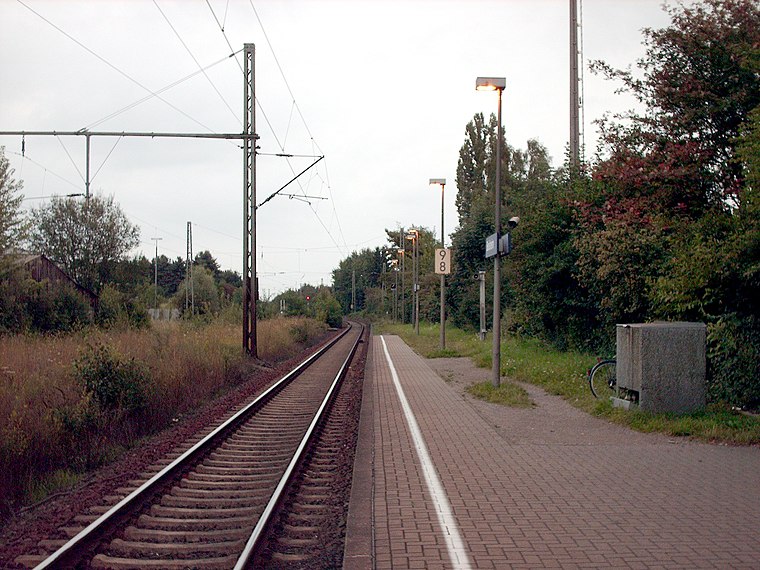
Photo: Stefan Flöper, CC BY-SA 4.0.
Boisheim is a railway station located in Boisheim, Germany. The station opened on 29 January 1866, and is located on the Viersen–Venlo railway. The train services are operated by Eurobahn. Boisheim station is situated 1½ km southwest of Landhof Hermans.
Burg Ingenhoven
Castle

Photo: Michielverbeek, CC BY-SA 3.0.
Burg Ingenhoven is a castle, which is situated 2 km north of Landhof Hermans.
St. Peter (Viersen-Boisheim)
Church

Photo: Rudolfo42, CC BY-SA 4.0.
St. Peter (Viersen-Boisheim) is a church, which is situated 2 km southwest of Landhof Hermans.
Places in the Area
Nearby places include Lobberich and Dülken.
Lobberich
Town

Photo: O.Falkner, CC BY-SA 3.0.
Lobberich is a German village in North Rhine-Westphalia, situated close to the Dutch border at Venlo. It has a population of around 14,000 inhabitants.
Dülken
Town

Photo: Stefan Flöper, CC BY-SA 4.0.
Dülken is a town located in the North Rhine-Westphalia state of Germany. It has a population of about 20,000. It is a borough of the municipality of Viersen. Dülken is situated 5 km southeast of Landhof Hermans.
Hinsbeck
Village

Photo: Palickap, CC BY-SA 4.0.
Hinsbeck is a village, which is situated 5 km north of Landhof Hermans.
Landhof Hermans
- Categories: shop and food
- Location: Viersen, Düsseldorf, North Rhine-Westphalia, Germany, Central Europe, Europe
- View on OpenStreetMap
Latitude
51.28585° or 51° 17′ 9″ northLongitude
6.28372° or 6° 17′ 1″ eastOpen location code
9F3877PM+8FOpenStreetMap ID
node 1383540160OpenStreetMap feature
shop=farm
This page is based on OpenStreetMap, Wikidata, and Wikimedia Commons.
We’d love your help improving our open data sources. Thank you for contributing.
Satellite Map
Discover Landhof Hermans from above in high-definition satellite imagery.
Notable Places Nearby
Highlights include Unterer Breyeller See and Breyeller See.
Nearby Places
Explore places such as Südsee Bar and B.A.N - Baumpflege am Niederrhein GmbH.
North Rhine-Westphalia: Must-Visit Destinations
Delve into Cologne, Düsseldorf, Bonn, and Dortmund.
Curious Farm Shops to Discover
Uncover intriguing farm shops from every corner of the globe.
About Mapcarta. Data © OpenStreetMap contributors and available under the Open Database License". Text is available under the CC BY-SA 4.0 license, except for photos, directions, and the map. Photo: Daniel Schwen, CC BY-SA 2.5.