Trosibodo
Trosibodo is a scenic viewpoint in Ausserberg, Raron District, Valais. Trosibodo is situated nearby to the church Leiggern-Kapelle, as well as near the cave Nasulecher.| Tap on a place to explore it |
Places of Interest Nearby
Highlights include Bietschtal viaduct BLS and Ausserberg railway station.
Bietschtal viaduct BLS
Bridge

Photo: Ttrainer, CC BY-SA 3.0.
Bietschtal viaduct BLS is a bridge, which is situated 1 km southwest of Trosibodo.
Ausserberg railway station
Railway station

Photo: NAC, CC BY-SA 4.0.
Ausserberg is a railway station in the Swiss canton of Valais and municipality of Ausserberg. The station is located on the Lötschberg line of the BLS AG, and is some 900 metres from the centre of Trogdorf, the main village of Ausserberg. Ausserberg railway station is situated 2 km southeast of Trosibodo.
Raron railway station
Railway station

Photo: Litzler, Public domain.
Raron railway station is a railway station in the municipality of Raron, in the Swiss canton of Valais. It is an intermediate stop on the Simplon line and is served by local trains only. Raron railway station is situated 3 km southwest of Trosibodo.
Places in the Area
Nearby places include Ausserberg and Raron.
Ausserberg
Village

Photo: Vasile Cotovanu, CC BY 2.0.
Ausserberg is a municipality in the district of Raron in the canton of Valais in Switzerland.
Raron
Village

Photo: Berger, CC BY-SA 3.0.
Raron is a municipality in the district of Raron in the canton of Valais in Switzerland. Raron is situated 3 km southwest of Trosibodo.
Baltschieder
Village
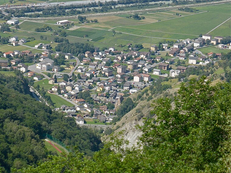
Photo: Albins, CC BY-SA 4.0.
Baltschieder is a municipality in the district of Visp in the canton of Valais in Switzerland. Baltschieder is situated 3½ km southeast of Trosibodo.
Trosibodo
- Type: Scenic viewpoint
- Category: tourism
- Location: Ausserberg, Raron District, Valais, Switzerland, Central Europe, Europe
- View on OpenStreetMap
Latitude
46.32706° or 46° 19′ 37″ northLongitude
7.82653° or 7° 49′ 36″ eastOpen location code
8FR98RGG+RJOpenStreetMap ID
node 1386551126OpenStreetMap feature
tourism=viewpoint
This page is based on OpenStreetMap, Wikidata, and Wikimedia Commons.
We’d love your help improving our open data sources. Thank you for contributing.
Satellite Map
Discover Trosibodo from above in high-definition satellite imagery.
Notable Places Nearby
Highlights include Leiggern-Kapelle and Nasulecher.
Nearby Places
Explore places such as Trosibodo and Leiggern.
Valais: Must-Visit Destinations
Delve into Sion, Zermatt, Martigny, and Brig.
Curious Scenic Viewpoints to Discover
Uncover intriguing scenic viewpoints from every corner of the globe.
About Mapcarta. Data © OpenStreetMap contributors and available under the Open Database License". Text is available under the CC BY-SA 4.0 license, except for photos, directions, and the map. Photo: Debugman, CC BY 3.0.