St. Jean, village
St. Jean, village is a bus stop in Anniviers, Sierre District, Valais and has an elevation of 1,320 metres. St. Jean, village is situated nearby to the village Saint-Jean, as well as near the church Chapelle Sainte-Marie-Madeleine.| Tap on a place to explore it |
Places of Interest Nearby
Highlights include Sainte-Euphémie church and Les 3 Caves blanches.
Sainte-Euphémie church
Church

Photo: Ji-Elle, CC BY-SA 3.0.
Sainte-Euphémie church is situated 2 km north of St. Jean, village.
Les 3 Caves blanches

Photo: Albins, CC BY-SA 3.0.
Les 3 Caves blanches is situated 2½ km south of St. Jean, village.
Moulins de Saint-Luc
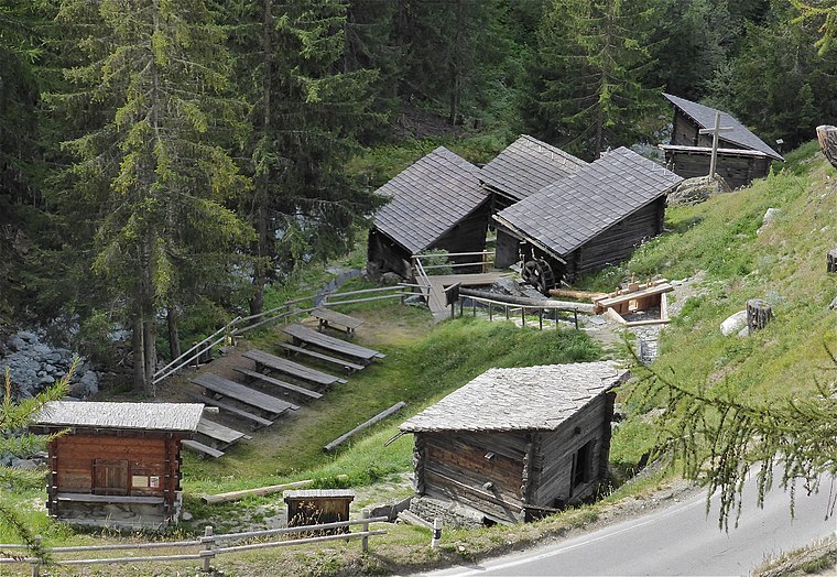
Photo: Albins, CC BY-SA 3.0.
Moulins de Saint-Luc is situated 2½ km northeast of St. Jean, village.
Places in the Area
Nearby places include Saint-Jean and Mission.
Saint-Jean
Village

Photo: Espandero, CC BY-SA 4.0.
Saint-Jean is a village in the district of Sierre in the Swiss canton of Valais. An independent municipality before, it merged on 1 January 2009 with neighboring Ayer, Chandolin, Grimentz, Saint-Luc and Vissoie to form the municipality of Anniviers.


St. Jean, village
- Type: Bus stop
- Category: transportation
- Location: Anniviers, Sierre District, Valais, Switzerland, Central Europe, Europe
- View on OpenStreetMap
Latitude
46.19813° or 46° 11′ 53″ northLongitude
7.58663° or 7° 35′ 12″ eastElevation
1,320 metres (4,331 feet)Operator
PAGOpen location code
8FR95HXP+7MOpenStreetMap ID
node 1387634999OpenStreetMap feature
highway=bus_stopOpenStreetMap feature
public_transport=platform
This page is based on OpenStreetMap, Wikidata, and Wikimedia Commons.
We’d love your help improving our open data sources. Thank you for contributing.
Satellite Map
Discover St. Jean, village from above in high-definition satellite imagery.
Notable Places Nearby
Highlights include Chapelle Sainte-Marie-Madeleine and Place de la Concorde.
Nearby Places
Explore places such as La Gougra and Orzival.
Valais: Must-Visit Destinations
Delve into Sion, Zermatt, Martigny, and Brig.
Curious Bus Stops to Discover
Uncover intriguing bus stops from every corner of the globe.
About Mapcarta. Data © OpenStreetMap contributors and available under the Open Database License". Text is available under the CC BY-SA 4.0 license, except for photos, directions, and the map. Photo: Debugman, CC BY 3.0.