District Agricultural Training Institute College
District Agricultural Training Institute College is a college in Tororo District, Eastern Uganda. District Agricultural Training Institute College is situated nearby to Uganda Cooperative College, as well as near Manjasi Secondary School.| Tap on a place to explore it |
Places of Interest Nearby
Highlights include Tororo Girls School and Tororo Rock.
Tororo Girls School
School
Tororo Girls Secondary School, commonly known as Tororo Girls School, is an all-girls boarding school covering grades 8 -13 in the Eastern Region of Uganda. Tororo Girls School is situated 680 metres west of District Agricultural Training Institute College.
Tororo Rock
Peak

Photo: Wikimedia, CC BY-SA 2.5.
Tororo Rock is a rock formation located in the town of Tororo in the Eastern Region of Uganda. It serves as the defining feature of the town. It is also a tourist attraction being climbable in around an hour. Tororo Rock is situated 2½ km northwest of District Agricultural Training Institute College.
Tororo Airport
Aerodrome
Tororo Airport is an airport serving the town of Tororo in the Eastern Region of Uganda. Tororo Airport is situated 3½ km northwest of District Agricultural Training Institute College.
Places in the Area
Nearby places include Tororo and Malaba.
Tororo
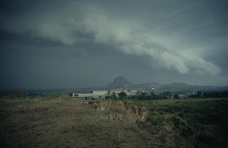
Photo: Wikimedia, CC BY-SA 2.5.
Tororo is a town in the Eastern Region of Uganda. It is the main municipal, administrative, and commercial center of Tororo District.
Malaba
Town
Malaba, Uganda is a town in Tororo District in the Eastern Region of Uganda, on its eastern border with Kenya. It sits adjacent from Malaba, Kenya, across the Malaba River that marks the border between Uganda and Kenya. Malaba is situated 8 km east of District Agricultural Training Institute College.
District Agricultural Training Institute College
- Type: College
- Description: school in Uganda
- Category: education
- Location: Tororo District, Eastern Uganda, Uganda, East Africa, Africa
- View on OpenStreetMap
Latitude
0.66471° or 0° 39′ 53″ northLongitude
34.19514° or 34° 11′ 43″ eastOpen location code
6GGPM57W+V3OpenStreetMap ID
node 1426281196OpenStreetMap feature
amenity=collegeWikidata ID
Q23673839
This page is based on OpenStreetMap, Wikidata, and Wikimedia Commons.
We’d love your help improving our open data sources. Thank you for contributing.
Satellite Map
Discover District Agricultural Training Institute College from above in high-definition satellite imagery.
Notable Places Nearby
Highlights include Uganda Cooperative College and Uganda Cooperative college Tororo.
Nearby Places
Explore places such as Nursery School and Rock Classic.
Eastern Uganda: Must-Visit Destinations
Delve into Jinja, Mbale, Soroti, and Tororo.
Curious Colleges to Discover
Uncover intriguing colleges from every corner of the globe.
About Mapcarta. Data © OpenStreetMap contributors and available under the Open Database License". Text is available under the CC BY-SA 4.0 license, except for photos, directions, and the map. Photo: Wikimedia, CC0.