Die Obstwiese
Die Obstwiese is in Waldfeucht, Heinsberg, North Rhine-Westphalia. Die Obstwiese is situated nearby to the church Kreuz Kapelle Haaserdriesch, as well as near the pitch Sportplatz Haaren.| Tap on a place to explore it |
Places of Interest Nearby
Highlights include Kapelle Hl. Familie and Feldkapelle (Hickeswinkel).
Kapelle Hl. Familie
Chapel

Photo: Wikimedia, CC BY-SA 3.0 de.
Kapelle Hl. Familie is a chapel, which is situated 1 km southeast of Die Obstwiese.
Feldkapelle (Hickeswinkel)
Church
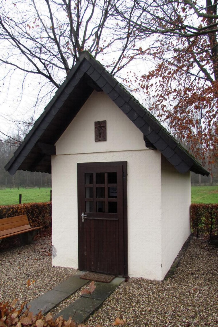
Photo: Wikimedia, CC BY-SA 3.0 de.
Feldkapelle (Hickeswinkel) is a church, which is situated 1¼ km northeast of Die Obstwiese.
Kitscher Mühle
Farm

Photo: Wikimedia, CC BY-SA 3.0 de.
Kitscher Mühle is a farm, which is situated 770 metres north of Die Obstwiese.
Places in the Area
Nearby places include Posterholt and Putbroek.
Posterholt
Village
Posterholt is a village in the Dutch province of Limburg. It is located in the municipality of Roerdalen. Posterholt is situated 3 km north of Die Obstwiese.
Putbroek
Hamlet

Photo: Havang(nl), CC0.
Putbroek is a hamlet, which is situated 4 km west of Die Obstwiese.
Heinsberg
Town

Photo: Bodoklecksel, CC BY-SA 3.0.
Heinsberg is a town in North Rhine-Westphalia, Germany. It is the seat of the district Heinsberg. It is situated near the border with the Netherlands, on the river Wurm, approx. 20 km north-east of Sittard and 30 km south-west of Mönchengladbach. Heinsberg is situated 4½ km southeast of Die Obstwiese.
Die Obstwiese
- Type: Sign
- Categories: information and tourism
- Location: Waldfeucht, Heinsberg, Cologne District, North Rhine-Westphalia, Germany, Central Europe, Europe
- View on OpenStreetMap
Latitude
51.09292° or 51° 5′ 35″ northLongitude
6.04854° or 6° 2′ 55″ eastOpen location code
9F3832VX+5COpenStreetMap ID
node 1428051008OpenStreetMap feature
tourism=information
This page is based on OpenStreetMap, Wikidata, and Wikimedia Commons.
We’d love your help improving our open data sources. Thank you for contributing.
Satellite Map
Discover Die Obstwiese from above in high-definition satellite imagery.
Notable Places Nearby
Highlights include Kreuz Kapelle Haaserdriesch and Sportplatz Haaren.
Nearby Places
Explore places such as Holzkreuz in der Kapelle and Ferienwohnung Vidok.
North Rhine-Westphalia: Must-Visit Destinations
Delve into Cologne, Düsseldorf, Bonn, and Dortmund.
Curious Places to Discover
Uncover intriguing places from every corner of the globe.
About Mapcarta. Data © OpenStreetMap contributors and available under the Open Database License". Text is available under the CC BY-SA 4.0 license, except for photos, directions, and the map. Photo: Daniel Schwen, CC BY-SA 2.5.