Alfred Lacroix
Alfred Lacroix is a greengrocer in Cercier, Arrondissement of Saint-Julien-en-Genevois, Auvergne-Rhône-Alpes. Alfred Lacroix is situated nearby to the church Église Notre-Dame-de-l’Assomption de Cercier, as well as near the town hall Mairie de Cercier.| Tap on a place to explore it |
Places of Interest Nearby
Highlights include Église Notre-Dame-de-l’Assomption de Cercier and Église Saint-André de Copponex.
Église Notre-Dame-de-l’Assomption de Cercier
Church

Photo: Chabe01, CC BY-SA 4.0.
Église Notre-Dame-de-l’Assomption de Cercier is a church.
Église Saint-André de Copponex
Church

Photo: Chabe01, CC BY-SA 4.0.
Église Saint-André de Copponex is a church, which is situated 3 km northeast of Alfred Lacroix.
Église Saint-Symphorien d’Andilly
Church

Photo: Pucesurvitaminee, CC BY-SA 4.0.
Église Saint-Symphorien d’Andilly is a church, which is situated 3½ km north of Alfred Lacroix.
Places in the Area
Nearby places include Choisy and Sallenôves.
Choisy
Village

Photo: OC, CC BY-SA 3.0.
Choisy is a commune in the eastern French department of Haute-Savoie. It lies 15 kilometers from Annecy and 35 kilometers from Geneva. Choisy is situated 3½ km south of Alfred Lacroix.
Sallenôves
Village
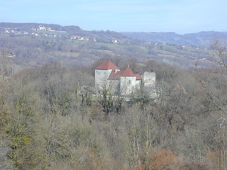
Photo: Semnoz, CC BY-SA 3.0.
Sallenôves is a commune in the Haute-Savoie department in the Auvergne-Rhône-Alpes region in south-eastern France. Sallenôves is situated 4½ km southwest of Alfred Lacroix.
Cruseilles
Village

Photo: Guilhem Vellut, CC BY 2.0.
Cruseilles is a commune in the Haute-Savoie department in the Auvergne-Rhône-Alpes region in Southeastern France. Cruseilles is on the A41 autoroute, 12 km south-southeast of Saint-Julien-en-Genevois. Cruseilles is situated 4½ km east of Alfred Lacroix.
Alfred Lacroix
- Type: Greengrocer
- Categories: shop and food
- Location: Cercier, Arrondissement of Saint-Julien-en-Genevois, Haute-Savoie, Auvergne-Rhône-Alpes, France, Europe
- View on OpenStreetMap
Latitude
46.02571° or 46° 1′ 33″ northLongitude
6.04871° or 6° 2′ 55″ eastOpen location code
8FR822GX+7FOpenStreetMap ID
node 1448528500OpenStreetMap feature
shop=greengrocer
This page is based on OpenStreetMap, Wikidata, and Wikimedia Commons.
We’d love your help improving our open data sources. Thank you for contributing.
Satellite Map
Discover Alfred Lacroix from above in high-definition satellite imagery.
Notable Places Nearby
Highlights include Mairie de Cercier and École primaire de Cercier.
Nearby Places
Explore places such as Cercier and Les Cortys.
Haute-Savoie: Must-Visit Destinations
Delve into Chamonix, Annecy, Annemasse, and Evian.
Curious Greengrocers to Discover
Uncover intriguing greengrocers from every corner of the globe.
About Mapcarta. Data © OpenStreetMap contributors and available under the Open Database License". Text is available under the CC BY-SA 4.0 license, except for photos, directions, and the map. Photo: Ypsilon from Finland, CC0.