Basel Rheinhafen/Dreiländereck
Basel Rheinhafen/Dreiländereck is a transport stop in Haut-Rhin, Grand Est. Basel Rheinhafen/Dreiländereck is situated nearby to the scenic viewpoint Foto-Spot Dreiländereck, as well as near the canal Hafenbecken 1.| Tap on a place to explore it |
Places of Interest Nearby
Highlights include Dreiländereck and Three Countries Bridge.
Dreiländereck
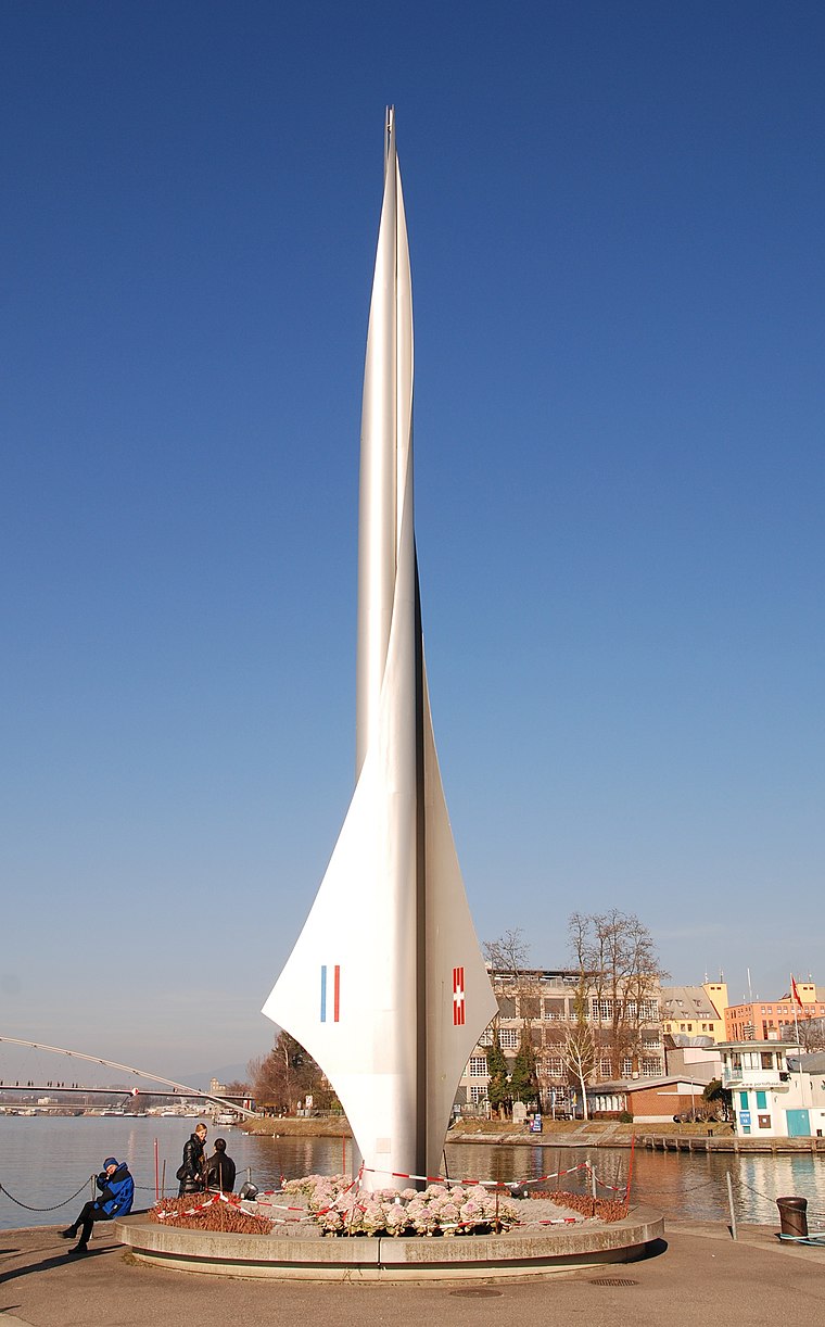
Photo: Taxiarchos228, CC BY-SA 3.0.
The Dreiländereck is a monument in Basel, Switzerland. It marks the tripoint where the borders of France, Germany and Switzerland meet. The France–Germany border, the Germany–Switzerland border and France–Switzerland border meet there. Dreiländereck is situated 120 metres northeast of Basel Rheinhafen/Dreiländereck.
Three Countries Bridge
Bridge

Photo: Taxiarchos228, CC BY 3.0.
The Three Countries Bridge is an arch bridge which crosses the Rhine between the commune of Huningue and Weil am Rhein, within the Basel metropolitan area. Three Countries Bridge is situated 450 metres north of Basel Rheinhafen/Dreiländereck.
Hafenmuseum Basel
Museum

Photo: Basmus, CC BY-SA 3.0.
Hafenmuseum Basel is situated 550 metres south of Basel Rheinhafen/Dreiländereck.
Places in the Area
Nearby places include Weil am Rhein and Saint-Louis.
Weil am Rhein

Photo: Joergens.mi, CC BY-SA 3.0.
Weil am Rhein is a German town and commune. It is on the east bank of the River Rhine, and extends to the tripoint of Switzerland, France, and Germany.
Saint-Louis

Photo: Comstagiaire SL, CC BY-SA 4.0.
Saint-Louis is a city of 23,000 people in Alsace in the Grand-Est at the German and Swiss borders, just north of Basel. Saint-Louis is rich in cultural resources and fun activities.

Basel Rheinhafen/Dreiländereck
- Type: Transport stop
- Categories: passenger ship terminal and transportation
- Location: Haut-Rhin, Grand Est, France, Europe
- View on OpenStreetMap
Latitude
47.58759° or 47° 35′ 15″ northLongitude
7.58897° or 7° 35′ 20″ eastElevation
242 metres (794 feet)Operator
BPGOpen location code
8FV9HHQQ+2HOpenStreetMap ID
node 1456410945OpenStreetMap feature
amenity=ferry_terminalOpenStreetMap feature
public_transport=stop_position
This page is based on OpenStreetMap, Wikidata, and Wikimedia Commons.
We’d love your help improving our open data sources. Thank you for contributing.
Satellite Map
Discover Basel Rheinhafen/Dreiländereck from above in high-definition satellite imagery.
Notable Places Nearby
Highlights include Foto-Spot Dreiländereck and Hafenbecken 1.
Nearby Places
Explore places such as Dreiländereck and Westquai.
Grand Est: Must-Visit Destinations
Delve into Strasbourg, Reims, Metz, and Nancy.
Curious Transport Stops to Discover
Uncover intriguing transport stops from every corner of the globe.
About Mapcarta. Data © OpenStreetMap contributors and available under the Open Database License". Text is available under the CC BY-SA 4.0 license, except for photos, directions, and the map. Photo: Wernain Samuel, CC BY-SA 3.0.