Alte Reitschule (Stadthalle)
Alte Reitschule (Stadthalle) is a community center in Weilburg, Giessen, Hesse which is located on Langgasse. Alte Reitschule (Stadthalle) is situated nearby to Mining- and Citymuseum Weilburg, as well as near the fountain Viehhofbrunnen.| Tap on a place to explore it |
Places of Interest Nearby
Highlights include Mining- and Citymuseum Weilburg and Schlosskirche Weilburg.

Schlosskirche Weilburg
Church

Photo: Beckstet, CC BY-SA 3.0.
Schlosskirche Weilburg is a church, which is situated 140 metres southeast of Alte Reitschule (Stadthalle).
Weilburg station
Railway station
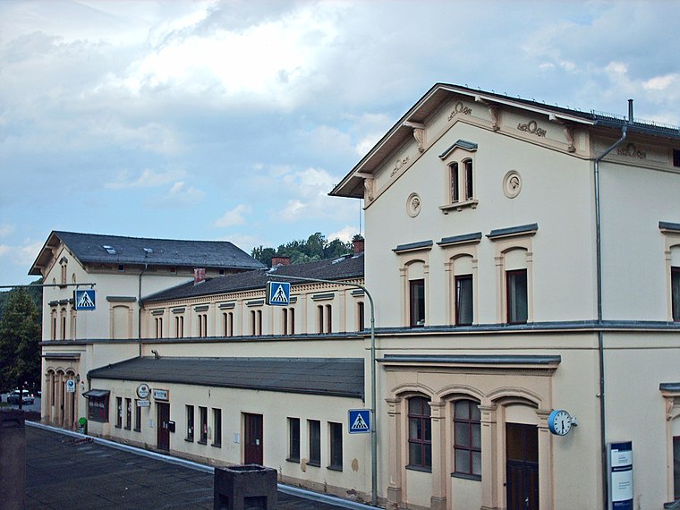
Photo: Stefan Flöper, CC BY-SA 4.0.
Weilburg is a station in the town of Weilburg in the German state of Hesse on the Lahn Valley Railway. The Weil Valley Railway branched off towards Weilmünster immediately after the station from 1890 to 1988. Weilburg station is situated 560 metres east of Alte Reitschule (Stadthalle).
Places in the Area
Nearby places include Laimbach and Ernsthausen.
Laimbach
Village
Laimbach is a village of the municipality of Weilmünster in the district of Limburg-Weilburg in central Hesse. It has around 230 inhabitants. Laimbach is situated 7 km east of Alte Reitschule (Stadthalle).
Ernsthausen
Village
 Ernsthausen is a village of the municipality of Weilmünster in the district of Limburg-Weilburg in central Hesse. It has around 600 inhabitants. Ernsthausen is situated 7 km southeast of Alte Reitschule (Stadthalle).
Alte Reitschule (Stadthalle)
- Type: Community center
- Address: Langgasse 25, Weilburg, 35781
- Location: Weilburg, Limburg-Weilburg, Giessen, Hesse, Germany, Central Europe, Europe
- View on OpenStreetMap
Latitude
50.48622° or 50° 29′ 10″ northLongitude
8.26056° or 8° 15′ 38″ eastOpen location code
9F2CF7P6+F6OpenStreetMap ID
node 1459266978OpenStreetMap feature
amenity=community_centre
This page is based on OpenStreetMap, Wikidata, and Wikimedia Commons.
We’d love your help improving our open data sources. Thank you for contributing.
Satellite Map
Discover Alte Reitschule (Stadthalle) from above in high-definition satellite imagery.
Notable Places Nearby
Highlights include Viehhofbrunnen and Delfinbrunnen.
Nearby Places
Explore places such as MotivMonster and Haar Schön.
Hesse: Must-Visit Destinations
Delve into Frankfurt, Wiesbaden, Darmstadt, and Kassel.
Curious Community Centers to Discover
Uncover intriguing community centers from every corner of the globe.
About Mapcarta. Data © OpenStreetMap contributors and available under the Open Database License". Text is available under the CC BY-SA 4.0 license, except for photos, directions, and the map. Photo: Pedelecs, CC BY-SA 3.0.