Valence Nord
Valence Nord is a tollbooth in Bourg-lès-Valence, Arrondissement of Valence, Auvergne-Rhône-Alpes. Valence Nord is situated nearby to the police station Gendarmerie nationale, as well as near the health club Inaout.| Tap on a place to explore it |
Places of Interest Nearby
Highlights include Centrale électrique de Bourg-lès-Valence and Théâtre Le Rhône.
Centrale électrique de Bourg-lès-Valence
Power station
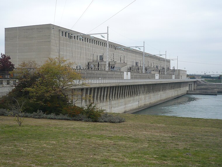
Photo: Roehrensee, CC BY-SA 4.0.
Centrale électrique de Bourg-lès-Valence is a power station, which is situated 1½ km southwest of Valence Nord.
Théâtre Le Rhône
Theater building

Photo: Johanboss, CC BY-SA 4.0.
Théâtre Le Rhône is a theater building, which is situated 3 km south of Valence Nord.
Our Lady Church
Church

Photo: FredSeiller, CC BY-SA 3.0.
Our Lady Church is situated 3 km west of Valence Nord.
Places in the Area
Nearby places include Pont-de-l’Isère and Guilherand-Granges.
Pont-de-l’Isère
Village

Photo: Sequajectrof, CC BY-SA 4.0.
Pont-de-l'Isère is a French commune, located in the department of Drôme and the Auvergne-Rhône-Alpes region. This town really emerged in 1866 when it was separated from La Roche-de-Glun. Pont-de-l’Isère is situated 4 km north of Valence Nord.
Guilherand-Granges
Town

Photo: Wikimedia, CC BY-SA 3.0.
Guilherand-Granges is a commune in the Ardèche department in southern France. It is a suburb of Valence, Drôme. It is one of the most populous commune in the Ardéche department, after Annonay and Aubenas, and before Tournon-sur-Rhône. Guilherand-Granges is situated 4½ km south of Valence Nord.
Saint-Péray
Village

Photo: Ukkel, CC BY-SA 3.0.
Saint-Péray is a commune in the Ardèche department in the Auvergne-Rhône-Alpes region in southern France. Historically part of the royal province of Vivarais, it has been a significant settlement since the 15th century when inhabitants moved from the fortified castle of Crussol to the valley of Mialan. Saint-Péray is situated 4½ km southwest of Valence Nord.
Valence Nord
- Type: Tollbooth
- Category: transportation
- Location: Bourg-lès-Valence, Arrondissement of Valence, Drôme, Auvergne-Rhône-Alpes, France, Europe
- View on OpenStreetMap
Latitude
44.97021° or 44° 58′ 13″ northLongitude
4.88741° or 4° 53′ 15″ eastOperator
ASFOpen location code
8FP6XVCP+3XOpenStreetMap ID
node 14961149
This page is based on OpenStreetMap, Wikidata, and Wikimedia Commons.
We’d love your help improving our open data sources. Thank you for contributing.
Satellite Map
Discover Valence Nord from above in high-definition satellite imagery.
In Other Languages
“Valence Nord” goes by many names.
- Occitan (post 1500): “Valença-Nòrd”
Places with the Same Name
Discover other places named “Valence Nord”.
Notable Places Nearby
Highlights include Gendarmerie nationale and Inaout.
Nearby Places
Explore places such as Valence Nord and Bourg-lès-Valence - Les Jonquettes.
Auvergne-Rhône-Alpes: Must-Visit Destinations
Delve into Lyon, Grenoble, Clermont-Ferrand, and Saint-Étienne.
Curious Tollbooths to Discover
Uncover intriguing tollbooths from every corner of the globe.
About Mapcarta. Data © OpenStreetMap contributors and available under the Open Database License". Text is available under the CC BY-SA 4.0 license, except for photos, directions, and the map. Photo: Mcleclat, CC BY-SA 3.0.