Södercentrum
Södercentrum is a bus stop in Kalmar, Kalmar Municipality, Kalmar County. Södercentrum is situated nearby to the park Margaretaplan, as well as near the church Vasakyrkan.| Tap on a place to explore it |
Places of Interest Nearby
Highlights include Saga and Kalmar Cathedral.
Saga
Movie theater

Photo: Simiha, CC BY-SA 4.0.
Saga is a movie theater, which is situated 790 metres east of Södercentrum.
Kalmar Cathedral
Church
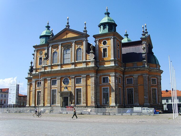
Photo: Västgöten, CC BY-SA 3.0.
Kalmar Cathedral is in the city of Kalmar in Småland in southeast Sweden. Located in Stortorget Square, construction began in 1660. The Cathedral was designed for the Church of Sweden by architect Nicodemus Tessin. Kalmar Cathedral is situated 1½ km east of Södercentrum.
Kalmar central station
Railway station

Photo: Kaare, CC BY-SA 4.0.
Kalmar central station is a railway station, which is situated 1¼ km east of Södercentrum.
Places in the Area
Nearby places include Rinkabyholm and Färjestaden.
Rinkabyholm
Village
Rinkabyholm is a locality situated in Kalmar Municipality, Kalmar County, Sweden with 1,607 inhabitants in 2010. Rinkabyholm is situated 5 km west of Södercentrum.
Färjestaden
Village

Photo: Bernt Fransson, CC BY-SA 4.0.
Färjestaden is a locality situated in Mörbylånga Municipality, Kalmar County, Sweden with 5,018 inhabitants in 2010. It is located in the southern part of the island of Öland, on the Kalmar Strait side, south of Borgholm. Färjestaden is situated 8 km east of Södercentrum.
Lindsdal
Village
Lindsdal is a locality situated in Kalmar Municipality, Kalmar County, Sweden with 5,510 inhabitants in 2010. Lindsdal is situated 9 km north of Södercentrum.
Södercentrum
- Type: Bus stop
- Categories: transport stop and transportation
- Location: Kalmar, Kalmar domkyrkoförs., Kalmar Municipality, Kalmar County, Sweden, Nordic countries, Europe
- View on OpenStreetMap
Latitude
56.66066° or 56° 39′ 38″ northLongitude
16.34012° or 16° 20′ 24″ eastNetwork
Kalmar LänstrafikOpen location code
9F8RM86R+72OpenStreetMap ID
node 1517208747OpenStreetMap feature
highway=bus_stopOpenStreetMap feature
public_transport=stop_position
This page is based on OpenStreetMap, Wikidata, and Wikimedia Commons.
We’d love your help improving our open data sources. Thank you for contributing.
Satellite Map
Discover Södercentrum from above in high-definition satellite imagery.
Notable Places Nearby
Highlights include Margaretaplan and Vasakyrkan.
Nearby Places
Explore places such as Södercentrum and Päronträdet.
Sweden: Must-Visit Destinations
Delve into Stockholm, Uppsala, Gothenburg, and Malmö.
Curious Bus Stops to Discover
Uncover intriguing bus stops from every corner of the globe.
About Mapcarta. Data © OpenStreetMap contributors and available under the Open Database License". Text is available under the CC BY-SA 4.0 license, except for photos, directions, and the map. Photo: Wikimedia, CC BY-SA 3.0.