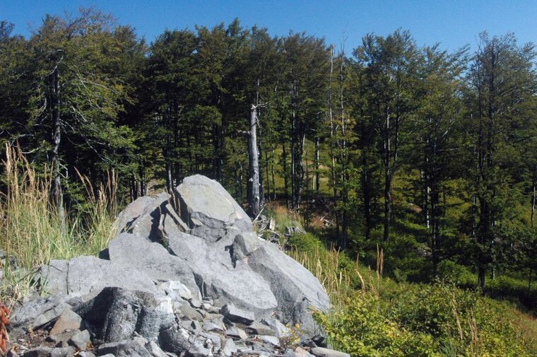
Jarabá skala
Jarabá skala is a peak in Slovakia and has an elevation of 1,169 metres. Jarabá skala is situated nearby to the locality Hrubá jedľa, as well as near Čierna dolina.| Tap on a place to explore it |
Photo: Doronenko, CC BY-SA 3.0.
Places of Interest
Highlights include Orlí kameň and Biela skala.


Places in the Area
Nearby places include Podhradie and Prochot.
Podhradie
Village
 Podhradie is a village and municipality in Prievidza District in the Trenčín Region of western Slovakia.
Prochot
Village
 Prochot is a village and municipality in Žiar nad Hronom District in the Banská Bystrica Region of central Slovakia.
Lehota pod Vtáčnikom
Village

Photo: Doronenko, Public domain.
Lehota pod Vtáčnikom is a village and municipality in Prievidza District in the Trenčín Region of western Slovakia.
Jarabá skala
- Type: Peak with an elevation of 1,169 metres
- Description: mountain in Slovakia
- Categories: mountain and landform
- Location: Slovakia, Central Europe, Europe
- View on OpenStreetMap
Latitude
48.6567° or 48° 39′ 24″ northLongitude
18.6641° or 18° 39′ 51″ eastElevation
1,169 metres (3,835 feet)Open location code
8FWWMM47+MJOpenStreetMap ID
node 1536681395OpenStreetMap feature
natural=peakWikidata ID
Q13419816
This page is based on OpenStreetMap, Wikidata, and Wikimedia Commons.
We’d love your help improving our open data sources. Thank you for contributing.
Satellite Map
Discover Jarabá skala from above in high-definition satellite imagery.
In Other Languages
From Czech to Slovak—“Jarabá skala” goes by many names.
- Czech: “Jarabá skala”
- Dutch: “Jarabá skala”
- Ladin: “Jarabá skala”
- Polish: “Jarabá skala”
- Slovak: “Jarabá skala”
Places with the Same Name
Discover other places named “Jarabá skala”.
Localities in the Area
Explore places such as Hrubá jedľa and Čierna dolina.
Notable Places Nearby
Highlights include Hrebienky and Sekaniny.
Slovakia: Must-Visit Destinations
Delve into Bratislava, Košice, Banská Bystrica, and Prešov.
Curious Peaks to Discover
Uncover intriguing peaks from every corner of the globe.
About Mapcarta. Data © OpenStreetMap contributors and available under the Open Database License". Text is available under the CC BY-SA 4.0 license, except for photos, directions, and the map. Photo: Doronenko, CC BY-SA 3.0.