Am Anger/WasserWanderWeg
Am Anger/WasserWanderWeg is in Amberg, Upper Palatinate, Bavaria. Am Anger/WasserWanderWeg is situated nearby to Königlich privilegierte Feuerschützengesellschaft 1434 Amberg, as well as near the health club Clever fit.| Tap on a place to explore it |
Places of Interest Nearby
Highlights include St. Martin and Vilstor.
St. Martin
Church
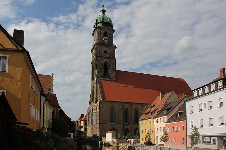
Photo: Mattis, CC BY-SA 3.0.
St. Martin is a church, which is situated 1½ km south of Am Anger/WasserWanderWeg.
Vilstor

Photo: Tilman2007, CC BY-SA 4.0.
Vilstor is situated 1¼ km south of Am Anger/WasserWanderWeg.
Provincial Library Amberg
Library

Photo: Mattes, Public domain.
Provincial Library Amberg is situated 1½ km south of Am Anger/WasserWanderWeg.
Places in the Area
Nearby places include Neumühle and Speckmannshof.

Speckmannshof
Village

Photo: Orzowei, CC BY-SA 3.0.
Speckmannshof is a village, which is situated 3 km west of Am Anger/WasserWanderWeg.
Schäflohe
Village

Photo: Threadder, CC BY-SA 3.0 de.
Schäflohe is a village, which is situated 3½ km west of Am Anger/WasserWanderWeg.
Am Anger/WasserWanderWeg
- Type: Information
- Category: tourism
- Location: Amberg, Upper Palatinate, Bavaria, Germany, Central Europe, Europe
- View on OpenStreetMap
Latitude
49.45729° or 49° 27′ 26″ northLongitude
11.85551° or 11° 51′ 20″ eastOpen location code
8FXHFV44+W6OpenStreetMap ID
node 1545656830OpenStreetMap feature
tourism=information
This page is based on OpenStreetMap, Wikidata, and Wikimedia Commons.
We’d love your help improving our open data sources. Thank you for contributing.
Satellite Map
Discover Am Anger/WasserWanderWeg from above in high-definition satellite imagery.
Notable Places Nearby
Highlights include Königlich privilegierte Feuerschützengesellschaft 1434 Amberg and Clever fit.
Nearby Places
Explore places such as WasserWanderWeg and Am Anger III.
Upper Palatinate: Must-Visit Destinations
Delve into Regensburg, Cham, Schwandorf, and Grafenwöhr.
Curious Places to Discover
Uncover intriguing places from every corner of the globe.
About Mapcarta. Data © OpenStreetMap contributors and available under the Open Database License". Text is available under the CC BY-SA 4.0 license, except for photos, directions, and the map. Photo: Mattis, CC BY-SA 3.0.