Ehemaliger U.S.-Schießstand (Osterholz Rifle Range)
Ehemaliger U.S.-Schießstand (Osterholz Rifle Range) is a shooting range in Ludwigsburg, Stuttgart, Baden-Württemberg. Ehemaliger U.S.-Schießstand (Osterholz Rifle Range) is situated nearby to the ruins 6-fach Schulschießanlage, as well as near the pitch Bogenschießplatz im Osterholz.| Tap on a place to explore it |
Places of Interest Nearby
Highlights include Asperg station and Ulrichskirche.
Asperg station
Railway station

Photo: Giftzwerg 88, CC BY-SA 3.0.
Asperg station is a station on the network of the Stuttgart S-Bahn in the German state of Baden-Württemberg, located at the 17.6 kilometre mark of the Franconia Railway. Asperg station is situated 1½ km northwest of Ehemaliger U.S.-Schießstand (Osterholz Rifle Range).
Ulrichskirche
Church

Photo: Fyrtaarn, CC BY-SA 3.0 de.
Ulrichskirche is a church, which is situated 1¼ km south of Ehemaliger U.S.-Schießstand (Osterholz Rifle Range).
St. Katharina
Church
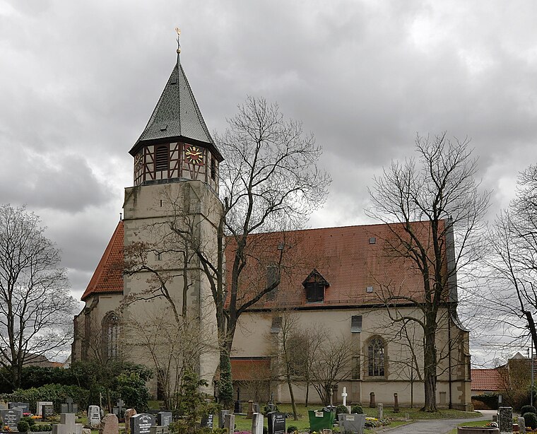
Photo: Wikimedia, CC BY-SA 3.0.
St. Katharina is a church, which is situated 1½ km northeast of Ehemaliger U.S.-Schießstand (Osterholz Rifle Range).
Places in the Area
Nearby places include Asperg and Eglosheim.
Asperg
Town

Photo: Schmelzle, CC BY-SA 3.0.
Asperg is a town in the district of Ludwigsburg, Baden-Württemberg, Germany.

Möglingen
Village

Photo: Mussklprozz, CC BY-SA 3.0.
Möglingen is a municipality in the district of Ludwigsburg, Baden-Württemberg, Germany. It is situated 13 km northwest of Stuttgart, and 5 km west of Ludwigsburg. Möglingen has the headquarter of the "Württemberger Weingärtner-Zentralgenossenschaft"…
Ehemaliger U.S.-Schießstand (Osterholz Rifle Range)
- Type: Shooting range
- Categories: ruins, historic site, military installation, and sports location
- Location: Ludwigsburg, Ludwigsburg, Stuttgart, Stuttgart Region, Baden-Württemberg, Germany, Central Europe, Europe
- View on OpenStreetMap
Latitude
48.8955° or 48° 53′ 44″ northLongitude
9.15491° or 9° 9′ 18″ eastOpen location code
8FWFV5W3+6XOpenStreetMap ID
node 1548193452OpenStreetMap feature
historic=ruinsOpenStreetMap feature
military=range
This page is based on OpenStreetMap, Wikidata, and Wikimedia Commons.
We’d love your help improving our open data sources. Thank you for contributing.
Satellite Map
Discover Ehemaliger U.S.-Schießstand (Osterholz Rifle Range) from above in high-definition satellite imagery.
Notable Places Nearby
Highlights include Osterholz and 6-fach Schulschießanlage.
Nearby Places
Explore places such as VS.tech and Shell.
Stuttgart Region: Must-Visit Destinations
Delve into Stuttgart, Esslingen, Sindelfingen, and Waiblingen.
Curious Shooting Ranges to Discover
Uncover intriguing shooting ranges from every corner of the globe.
About Mapcarta. Data © OpenStreetMap contributors and available under the Open Database License". Text is available under the CC BY-SA 4.0 license, except for photos, directions, and the map. Photo: Traveler100, CC BY-SA 3.0.