Josef Braun
Josef Braun is a memorial in Trojanovice, Nový Jičín District, Moravian-Silesian Region. Josef Braun is situated nearby to the sports venue Lanové centrum Tarzania, as well as near the pitch Minigolf Troyer.| Tap on a place to explore it |
Places of Interest Nearby
Highlights include Radhošť and Chapel of Saints Cyril and Methodius on Radhošť.
Radhošť
Peak

Photo: Twisp, Public domain.
Radhošť is a mountain in the Czech Republic. It has an elevation of 1,129 metres and belongs to the Moravian-Silesian Beskids mountain range. It is located in Dolní Bečva and Trojanovice municipalities in the Zlín and Moravian-Silesian regions, whose border runs along the ridge of the mountain. Radhošť is situated 2½ km southwest of Josef Braun.
Chapel of Saints Cyril and Methodius on Radhošť
Church

Photo: Ben Skála, CC BY-SA 3.0.
Chapel of Saints Cyril and Methodius on Radhošť is a church, which is situated 2½ km southwest of Josef Braun.
Velká Stolová
Peak

Photo: Maoman, Public domain.
Velká Stolová is a peak, which is situated 4 km east of Josef Braun.
Places in the Area
Nearby places include Trojanovice and Pustevny.
Trojanovice
Village

Photo: Podzemnik, CC BY-SA 3.0.
Trojanovice is a municipality and village in Nový Jičín District in the Moravian-Silesian Region of the Czech Republic. It has about 2,800 inhabitants.
Pustevny
Hamlet

Photo: Maxx, CC BY-SA 3.0.
Pustevny is a mountain saddle in the Moravian-Silesian Beskids mountain range of the Czech Republic, not far from Radhošť, in the municipality of Prostřední Bečva.
Kunčice pod Ondřejníkem
Village
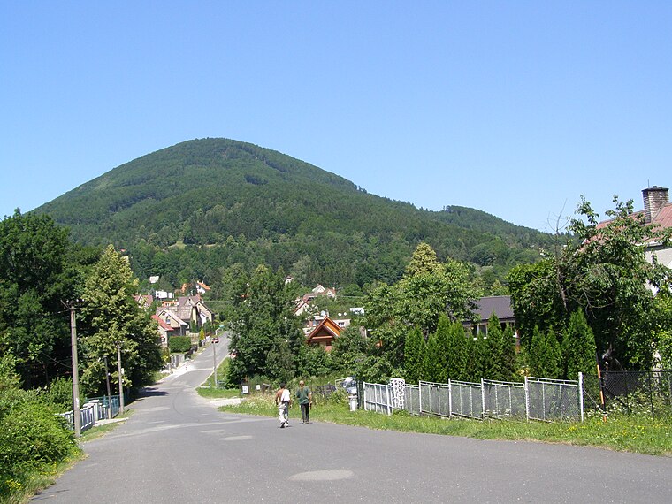
Photo: Daniel Baránek, CC BY-SA 3.0.
Kunčice pod Ondřejníkem is a municipality and village in Frýdek-Místek District in the Moravian-Silesian Region of the Czech Republic. It has about 2,500 inhabitants. Kunčice pod Ondřejníkem is situated 4½ km northeast of Josef Braun.
Josef Braun
- Type: Memorial
- Category: historic site
- Location: Trojanovice, Nový Jičín District, Moravian-Silesian Region, Czech Republic, Central Europe, Europe
- View on OpenStreetMap
Latitude
49.50791° or 49° 30′ 29″ northLongitude
18.24748° or 18° 14′ 51″ eastOpen location code
8FXWG65W+5XOpenStreetMap ID
node 1561709676OpenStreetMap feature
historic=memorial
This page is based on OpenStreetMap, Wikidata, and Wikimedia Commons.
We’d love your help improving our open data sources. Thank you for contributing.
Satellite Map
Discover Josef Braun from above in high-definition satellite imagery.
Places with the Same Name
Discover other places named “Josef Braun”.
Notable Places Nearby
Highlights include Lanové centrum Tarzania and Minigolf Troyer.
Nearby Places
Explore places such as Trojanovice, rest. Ráztoka and Malá Ráztoka - Můstek.
Czech Republic: Must-Visit Destinations
Delve into Prague, Brno, Pilsen, and Ostrava.
Curious Memorials to Discover
Uncover intriguing memorials from every corner of the globe.
About Mapcarta. Data © OpenStreetMap contributors and available under the Open Database License". Text is available under the CC BY-SA 4.0 license, except for photos, directions, and the map. Photo: john mcsporran, CC BY 2.0.