Baggot Street Lower
Baggot Street Lower is a bus stop in Dublin, Leinster. Baggot Street Lower is situated nearby to the government office Department of Health, as well as near Department of Children, Equality, Disability, Integration and Youth.| Tap on a place to explore it |
Places of Interest Nearby
Highlights include National Library of Ireland and Leinster House.
National Library of Ireland
Library
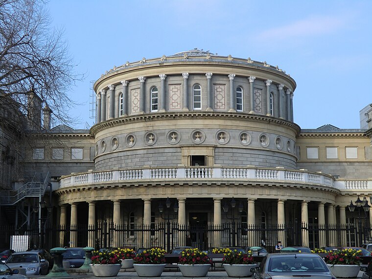
Photo: YvonneM, CC BY-SA 3.0.
The National Library of Ireland is Ireland's national library located in Dublin, in a building designed by Thomas Newenham Deane. The mission of the National Library of Ireland is "To collect, preserve, promote and make accessible the documentary and… National Library of Ireland is situated 650 metres northwest of Baggot Street Lower.
Leinster House
Public building

Photo: Jeanhousen, CC BY-SA 3.0.
Leinster House is the seat of the Oireachtas, the parliament of Ireland. Originally, it was the ducal palace of the Dukes of Leinster. Since 1922, it has been a complex of buildings which houses Oireachtas Éireann, its members and staff. Leinster House is situated 560 metres northwest of Baggot Street Lower.
Embassy of France
Government office

Photo: Yoannd38, CC BY-SA 4.0.
The Embassy of France in Ireland is the diplomatic mission of the French Republic in Ireland. It is located in Dublin. As of January 2024, the current ambassador to Ireland is Céline Place. Embassy of France is situated 220 metres northwest of Baggot Street Lower.
Places in the Area
Nearby places include Ranelagh and Temple Bar.
Ranelagh
Suburb

Photo: Cqui, CC BY-SA 3.0.
Ranelagh is an affluent residential area and urban village on the Southside of Dublin, Ireland in the postal district of Dublin 6. Ranelagh was originally a village called Cullenswood.
Temple Bar
Quarter
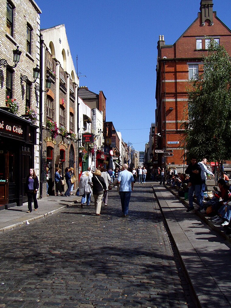
Photo: Wikimedia, Public domain.
Dublin is the capital city of Ireland. Its vibrancy, nightlife and tourist attractions are world renowned and it's the most popular entry point for international visitors to Ireland.
Ballsbridge
Suburb

Photo: Sarah777, Public domain.
Ballsbridge is an affluent neighbourhood of the city of Dublin, Ireland. The area is largely situated north and west of a three-arch stone bridge across the River Dodder, on the south side of the city.
Baggot Street Lower
- Type: Bus stop
- Category: transportation
- Location: Dublin, Leinster, Ireland, Britain and Ireland, Europe
- View on OpenStreetMap
Latitude
53.33657° or 53° 20′ 12″ northLongitude
-6.24843° or 6° 14′ 54″ westOperator
Dublin BusNetwork
Dublin BusOpen location code
9C5M8QP2+JJOpenStreetMap ID
node 1589739797OpenStreetMap feature
highway=bus_stopOpenStreetMap feature
public_transport=platform
This page is based on OpenStreetMap, Wikidata, and Wikimedia Commons.
We’d love your help improving our open data sources. Thank you for contributing.
Satellite Map
Discover Baggot Street Lower from above in high-definition satellite imagery.
Places with the Same Name
Discover other places named “Baggot Street Lower”.
Notable Places Nearby
Highlights include Department of Health and Department of Children, Equality, Disability, Integration and Youth.
Nearby Places
Explore places such as Baggot Street Lower and Eathos.
Ireland: Must-Visit Destinations
Delve into Cork, Limerick, Galway, and Waterford.
Curious Bus Stops to Discover
Uncover intriguing bus stops from every corner of the globe.
About Mapcarta. Data © OpenStreetMap contributors and available under the Open Database License". Text is available under the CC BY-SA 4.0 license, except for photos, directions, and the map. Photo: Wikimedia, CC0.